Fun SW swells, cleanest from Thursday
Western Australia Surf Forecast by Craig Brokensha (issued Monday 9th October)
Best Days: Perth and Mandurah Wednesday morning, all regions Thursday and Friday mornings, the South West Saturday morning
Recap
A good kick in SW swell through Saturday though onshore in the South West and cleaner to the north with peaky 2-3ft waves around Mandurah and a smaller 1-2ft around Perth.
Sunday saw a bit more size again with a secondary SW swell filling in at locations north of Margs continued to offer the best conditions.
This morning the swell was easing and most locations were clean, though we saw the tricky winds across the South West, offshore to the north and onshore from about Margs, south.
This week and weekend (Oct 10 - 15)
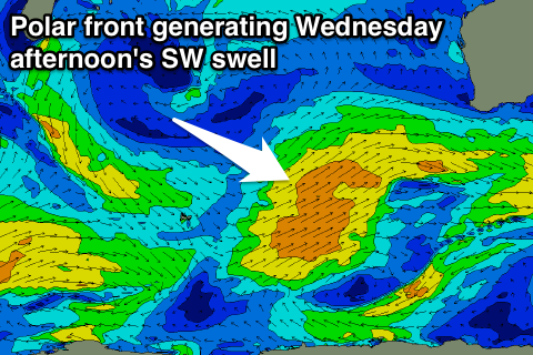
We're currently seeing a series of weak but broad polar fronts pushing and clipping us, and with this we'll see onshore winds across all locations with a building SW groundswell tomorrow, followed by a secondary reinforcing pulse Wednesday afternoon, easing Thursday.
We should see the South West building to the 6ft range tomorrow afternoon, with a stronger increase Wednesday afternoon to 6ft+, easing back from the 6ft range on Thursday morning.
Mandurah should see 2ft+ waves from tomorrow afternoon through Wednesday morning, with 2ft sets in Perth.
 Fresh to strong W tending SW winds will impact all locations tomorrow, with SW tending W/SW winds Wednesday across the South West. Perth and Mandurah are likely to see morning SE offshores.
Thursday then looks great across all locations with a SE-E/SE offshore winds, tending S/SE through the afternoon.
Friday will be clean again though the swell smaller and easing from 4-5ft and 1-2ft respectively.
Into the weekend a small but persistent polar low will generate a fun SW groundswell for Saturday, building through the day, peaking into the afternoon and easing Sunday.
At this stage we're looking at early offshore winds Saturday morning, shifting N/NW into the afternoon and building sets to 4-6ft across the South West and 1-2ft to the north. Sunday will then likely see onshore winds (possibly variable early) with an approaching trough.
We may see this trough form into a mid-latitude low generating some onshore swell for early next week, but check back here on Wednesday for an update on this.

