New swells for the weekend, cleanest to the north
Western Australia Surf Forecast by Craig Brokensha (issued Friday 6th October)
Best Days: Perth and Mandurah Saturday and Sunday mornings, all locations besides the southern end of the cape Monday morning, Perth and Mandurah Wednesday/Thursday mornings
Recap
Good fun waves across the South West yesterday with clean 4ft sets as offshore winds lasted until mid-afternoon. Mandurah and Perth were in the small to tiny range but also nice and clean.
Today a new swell has bumped up wave heights across all regions with clean fun 1-2ft waves on the Perth and Mandurah coasts with 3-5ft sets in the South West. Early offshore winds are now shifting across the state.
This weekend and next week (Oct 7 - 13)
Today's onshore change is linked to the first of two polar fronts pushing up and across us, linked to two separate large SW swells.
We should see the first swell filling in tomorrow, with mid-period energy in the morning and stronger SW groundswell into the afternoon, reaching 6ft+ across the South West and 2-3ft across Mandurah, 2ft+ around Perth.
The secondary front will be a touch stronger and move on top of the already active sea state, producing a secondary pulse of SW groundswell for Sunday afternoon, reaching 6-8ft across the South West and 2-3ft in Perth and Mandurah.
 Winds all weekend will however be poor across the South West with a fresh to strong SW tending W/SW breeze tomorrow and weaker SW winds Sunday.
Perth and Mandurah are now looking better with an early S/SE breeze tomorrow morning and variable winds Sunday morning.
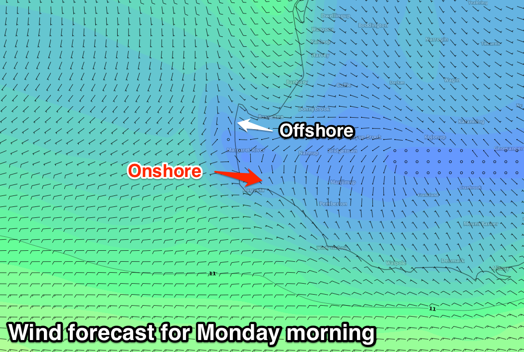
Into Monday a high pressure ridge will move in from the west resulting in light offshore E'ly winds developing across Perth and Mandurah, but the South West will be mixed.
The northern half of the region looks to see variable winds, while the southern half will see onshore W/NW winds.
This will be linked to a couple of trailing polar fronts firing up towards us through the weekend and early next week.
The size off these systems looks limited, with no major core wind strengths within the fronts.
But coming back to the size on Monday morning, the South West should ease from 6ft+ with 2-3ft sets to the north.
The reinforcing energy out of the SW doesn't look to top 6ft across the South West and 2ft+ further north late Tuesday, through Wednesday and easing Thursday.
Winds look onshore for the period across the South West, with better S/SE offshores around Perth and Mandurah Wednesday morning, SE Thursday. We'll see better offshore winds Friday morning across the South West as the swell continues to ease. More on this Monday though. Have a great weekend!

