Strong swell Friday with onshores, fun early next week
Western Australia Surf Forecast by Craig Brokensha (issued Wednesday 17th June)
Best Days: Monday, Tuesday, Wednesday exposed spots
Recap
Clean fun building swell across the South West yesterday, great into the afternoon with easy 6ft sets across exposed breaks under offshore winds. Perth only saw a small kick to an inconsistent 2ft, before fading back into this morning. Margs was much smaller as well and in the 4-5ft range.
This week and weekend (Jun 18 - 21)
The surf will continue to ease into tomorrow with exposed breaks in the South West out of the fresh to strong N/NE wind the only real option.
Come Friday a good new SW groundswell pulse is due across the state, generated by a vigorous polar low firing up south-west of the state on Monday.
Satellite observations have confirmed a fetch of storm-force W/NW winds through our swell window, with the low currently in a weaker form, pushing east along the polar shelf.
A strong and long-period SW groundswell is due from this low, peaking Friday morning in the South West and through the day around Perth, with it arriving very late in the day in the North West, peaking Saturday morning.
Exposed spots should offer inconsistent 6ft to occasionally 8ft sets, with 2ft waves in Perth and 4-6ft sets in the North West.
Winds aren't looking too flash though with a moderate N/NW breeze across Perth and Margs Friday and then W/NW winds into Saturday, shifting W/SW through the day. The North West should see variable light SE winds early Saturday, remaining variable into the afternoon.
There'll also be some weak W/NW windswell in the mix across Perth and W/SW up in the North West into the end of the week, but to no major size.
A strong S/SW change due Sunday has been weakened with an easing swell under moderate to fresh S/SW tending S/SE breezes.
 Next week onwards (Jun 22 onwards)
We've still got the S/SW groundswell due Monday linked to Sunday's S/SW change, with the front responsible for it spawning off a strong polar low.
This low will form late in our swell window, with winds reaching the severe-gale range, producing a fun S/SW groundswell pulse mainly for the South West to 5-6ft range, with 1-2ft sets in Perth through the middle of the day onwards. The North West should see the swell for Tuesday morning to 3-4ft+ or so.
Conditions look much better Monday as winds swing offshore from the E/SE and persist from the E Tuesday.
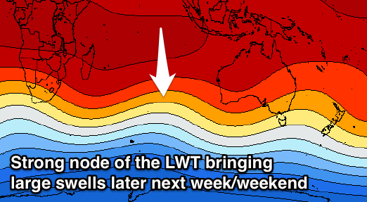
Longer term, a strong node of the Long Wave Trough is forecast to move in through the Indian Ocean early next week, bringing with it a flurry of broad, strong and vigorous frontal activity.
This should produce at least one if not two large W/SW groundswells for later in the week/weekend. Winds at this stage are too hard to pin down but may be variable, but we'll have a closer look at this on Friday.


Comments
Still a ways out but models have some pretty significant numbers for the 22nd onward!!! Indian is lit up