Small windows between large swell pulses
Western Australia Surf Forecast by Craig Brokensha (issued Wednesday 18th June)
Best Days: Thursday around Gero, Friday morning around Perth and Gero, later Sunday in protected locations, Monday morning, Tuesday morning
Recap
Yesterday was a write off across most regions with small average waves and fresh cross-onshore winds ahead of an approaching cold front.
This front moved through during the day and with it today, a kick in windswell and larger W/SW groundswell was seen in the 10-12ft+ range in the South West, 3-4ft in Perth and 6ft or so around Gero. Conditions were poor across all locations though with a fresh to strong W/SW breeze.
This week (Jun 19 -20)
Today's large and stormy mix of swells should ease through tomorrow from 6-8ft+ in the South West, 3ft in Perth and 5-6ft+ up at Gero but winds will remain onshore from the W/SW from Perth South, with Gero seeing more variable winds creating lumpy/wobbly but workable conditions.
Friday will be smaller again but Perth should see better conditions with a variable breeze through the morning, with light E/NE offshores around Gero. Margs will remain poor with a moderate W/NW tending strong N/NW wind ahead of another approaching front.
This weekend onwards (Jun 21 onwards)
The weekend will become large and stormy again as a vigorous frontal system moves in from the west. This system is currently north of the Heard Island with a broad fetch of W/SW gales being aimed towards us. This system will continue pushing east-northeast while strengthening this evening and tomorrow, setting in motion a large SW groundswell for Indo and a W/SW groundswell for us on Sunday.
Before this swell arrives though, medium-large levels of W'ly windswell will develop Saturday with strong N/NW tending W/SW winds, while as the swell peaks Sunday, poor and strong S/SW winds are due. Winds should ease later and tend more S'ly opening up protected locations towards dark.
Size wise, Margs should see large 10-12ft waves Sunday, 3-4ft sets in Perth and 6-8ft+ surf up at Gero. A rapid drop in size is then expected Monday and Tuesday as winds improve, swinging offshore from the E/SE around Perth and Gero, with SE winds around Gero. Tuesday then should see E/NE tending variable winds north of Margs, with NE tending N/NW winds in the South West.
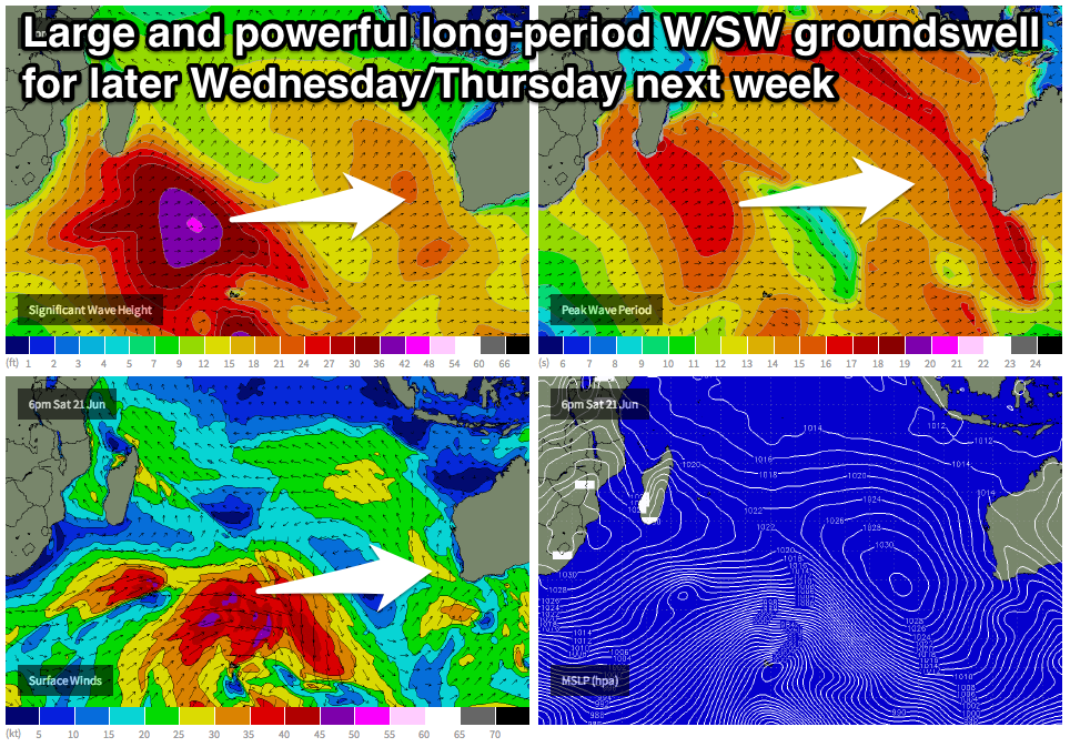
 Longer term a long-range but very powerful W/SW groundswell is due across the state later Wednesday/Thursday, generated by a broad, vigorous and intense polar frontal progression firing up below South Africa tomorrow and Friday before pushing east through the Southern Indian Ocean over the weekend. The system will break down above Heard Island leaving a long-period groundswell to spread out towards us.
This swell should arrive later Wednesday, pulsing to 8-10ft on dark in the South West, with a peak due overnight and drop from 8-10ft+ Thursday morning. Perth should see solid 3ft sets, with stronger 6-8ft+ waves around Gero.
Winds Thursday morning look a little dicey and from the northern quadrant around Margs but further north more favourable NW winds are due. We'll review all this again on Friday though.

