Tricky winds this week, but Friday's looking fun

Victorian Forecast by Ben Matson (issued Monday March 10th)
Features of the Forecast (tl;dr)
- New groundswell for Tues but E'ly winds will spoil the Surf Coast (best conditions east of Melbourne)
- Peaky mix of leftover SW and SE swell for Wed with early light winds
- Friday is the pick of the forecast period with a new long period groundswell and generally light winds
- Smaller surf Sat with light winds
- New long period groundswell building Sunday, good winds early
- Stacks of swell for next week with favourable winds more often than not
Recap
Small surf and light offshore winds prevailed across the Victorian coast from Saturday thru Monday, offering ideal conditions for the open beaches east of Melbourne (3ft+ sets) but only small waves to the east (1-2ft).
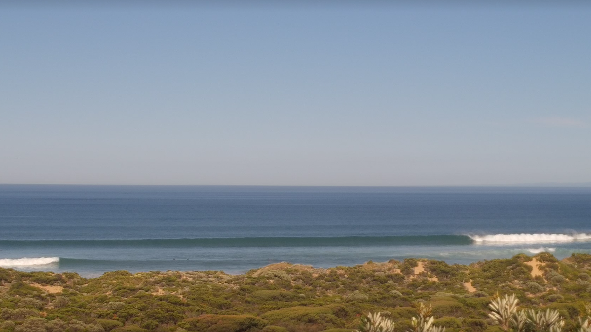
Nice lines east of Melbourne this morning
This week (Mar 11 - 14)
The leading edge of a new long period groundswell reached Cape Sorell around lunchtime today, and will build towards a peak on Tuesday.
Unfortunately, a strengthening high pressure system south of Tasmania will freshen easterly winds across the coast during Tuesday morning, creating messy conditions west of Torquay. There is a chance for a brief window of light variable winds at dawn but it has a low probability of occurring across most regions, so keep your expectations in check.
Size wise (and without a lot of time to properly hindcast the storm that generated this swell), I’ll hold steady with Craig’s Friday estimate of inconsistent 3ft sets in Torquay with 4-6ft surf east of Melbourne.
It’s difficult to have confidence in the prospects of good waves east of Melbourne as these kinds of distant groundswells can sometimes overpower the banks, whilst not providing enough activity between-sets to capitalise on. However, conditions will be reasonably clean across the Peninsula and Island’s exposed stretches, though expect a slight trend towards the E/SE or maybe SE through the day.
We’ll also see some local SE windswell build across the Surf Coast into the afternoon, reaching 3ft well to the west of Torquay by late afternoon.
Both swell sources will ease into Wednesday and winds will veer light N’ly as a weak trough approaches from the west, bringing a shallow mid-afternoon change to the Surf Coast (late afternoon east of Melbourne). Lumpy leftovers are likely west of Melbourne - mainly SE windswell in the 2-3ft range - with bigger, better (though inconsistent) 4-5ft sets east of Melbourne easing to 3-4ft as the day progresses, much cleaner on top thanks to the absence of abating windswell noise as will be the case along the Surf Coast.
Thursday will be between swells, with lingering onshore winds and small waves across most regions. There won’t be much to work around.
However, during the day we’ll see some new long period swell reach the Cape Sorell buoy, that will show across the Victorian coast on Friday.
This energy will be generated by a slow moving polar low well to the SW of Western Australia at the moment, in an ideally angled - if somewhat distant - region of our swell window.
Surf size should build to 2-3ft+ across the Surf Coast, though there will be extremely long breaks between the sets (and not much between ‘em, either). East of Melbourne should push 4-5ft+ at times, and both casts are looking to remain clean with an absence of wind thanks to a weak high pressure system influencing the Victorian region.
So, Friday is the pick of the working week.
This weekend (Mar 15 - 16)
A series of powerful fronts pushing through the Southern Ocean this week will setup an overlapping sequence of SW groundswells that'll arrive during the weekend.
At this stage, Saturday looks to start off with small leftovers from Friday though we could see a minor reinforcement of mid-range swell from a pre-frontal W/NW fetch (this may lift the inconsistent baseline 2ft surf a touch). Bigger 3-4ft+ surf is expected east of Melbourne with some fun options around.
However Sunday is where we’ll see a strong building trend, from 2-3ft early in Torquay, up to 4-5ft+ by the afternoon along with freshening NW tending W’ly then possibly W/SW winds.
East of Melbourne will see a similar swell trend, but with a couple of extra feet on top. This suggests the late session could be beneficial for Western Port and other sheltered locations under the strengthening westerly flow.
Let’s fine tune the specifics on Wednesday.
Next week (Mar 17 onwards)
All signs are pointing towards an extended run of strong Southern Ocean fronts into next week (i.e. with a negative SAM), which suggests a decent spell of elevated wave heights along the Victorian coast. However, the high pressure belt may remain just south enough to keep the local influence of westerly winds to a minimum. This could result in favourable conditions for more than one stretch of coast at times as the swell cycles through various events.
Anyway, it’s early days for now, but a very promising run of Autumn swell looks imminent.