Plenty of swell enroute, but tricky winds abound
Victorian Forecast by Ben Matson (issued Wednesday November 13th)
Features of the Forecast (tl;dr)
- Easing onshore winds and building groundswell Thursday, looking best early Friday with early light winds
- Fun beachies most coasts early Saturday with freshening NE winds and easing swells
- Very small Sunday with strengthening onshores (a'noon windswell increase)
- Good waves on Monday with early light winds and strong surf west of Melbourne (also good inside W'Port)
- Easing surf Tues/Wed
- Another decent groundswell Thurs/Fri but local winds could be an issue
Recap
Onshore winds deteriorated surf conditions in Torquay on Thursday morning, though the reefs were still 3-4ft early, easing a little through the day. Winds eased up into the afternoon and allows conditions to improve a touch. East of Melbourne was clean with solid, 4-6ft surf at open beaches easing through the day. A further drop in size this morning (2ft west of Melb, 3-4ft east) was initially clean with light winds however a mid-morning onshore change rapidly deteriorated conditions across all coasts.

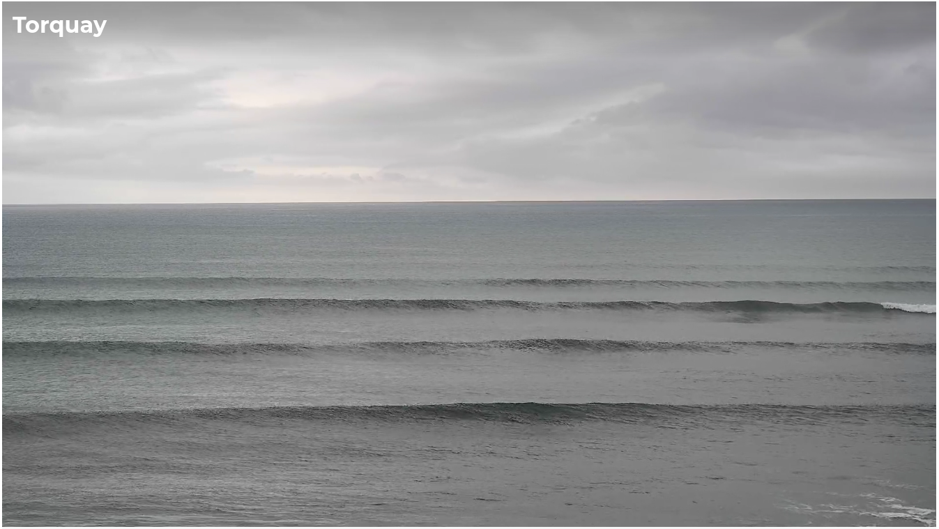
Still some small lines in Torquay this morning, before the onshore change
This week (Nov 14 - 15)
A new swell is expected to build slowly on Thursday plateauing from the afternoon into Friday with 3ft sets across the Surf Coast and 4-5ft sets east of Melbourne.
This swell is being generated by a modest series of fronts traversing the Southern Ocean - a long fetch is trailing behind them, but it’s not terribly strong so I’m being cautious with my size estimates.
The main issue for the next few days will be local winds. Easing onshores are expected into Thursday, they’ll abate quite a bit but surface conditions will only improve gradually, and I’m not very confident for an early window of light W’ly winds (west of Torquay) to tip the balance in our favour either. As it is, wave heights may be undersized at this time anyway (ahead of the afternoon peak), so keep your expectations in check.
Light variable winds are expected Friday morning - this will probably see the best conditions of the period - but south-easterly breezes are expected to develop into the afternoon, so aim for a morning paddle.
Either way, there’ll be plenty of waves around with Friday morning your best chance for a paddle; most open beaches on both coasts should have options.
This weekend (Nov 16 - 17)
A powerful mid-latitude low developing to our west will influence local winds this weekend, initially from the NE on Saturday then the west on Sunday, at strength by the afternoon.
Saturday’s looking like a great morning for the open beaches everywhere, with easing size from Friday (2-3ft west of Melbourne, 3-5ft to the east) in addition to a brief flush of short period SE swell, generated by a burgeoning fetch developing west of Flinders Island (inside Bass Strait) early Friday morning. This small swell will only favour the Surf Coast, with the biggest waves well to the west of Torquay (2ft or so).
An initial W’ly change will push through Bass Strait before dawn on Sunday but local winds will temporarily relax at dawn before swinging strong W/SW around lunchtime as the main front pushes through. Surf size will be bvery small by this point, down to a foot in Torquay and perhaps 2-3ft east of Melbourne. It's not worth getting excited about.
The bulk of the groundswell associated with this low is not expected to arrive until Monday so the most activity we’ll see Sunday afternoon will be a local windswell increase.
Next week (Nov 18 onwards)
Large swells will build on Monday morning and although the synoptic flow will be out of the SW for much of the day, we should see a period of early light W/NW winds west of Torquay. This should allow surface conditions to clean up to a degree, however there will likely be some leftover wobble at exposed spots.
The Surf Coast is expected to build to 4-6ft, with 6-8ft+ surf across exposed spots east of Melbourne - it's looking like another nice round of surf for Western Port.
Surf size will then steadily ease into Tuesday and Wednesday with winds becoming light and variable, before easterlies redevelop later Wednesday and early Thursday.
Looking further out and a deep polar low skirting the ice shelf well south of WA early next week will set up an excellent groundswell for the Victorian region around Thursday and Friday. Early indications are for 4-5ft sets in Torquay from this source, however there is some concern about local winds; Thursday’s easterlies should ease back on Friday but it may cause irreparable damage to surface conditions at many spots.
However, this is still some time away so let’s take a closer look on Friday.

