A week of solid, blustery surf ahead (after the weekend)
Victorian Surf Forecast by Ben Matson (issued Friday July 19th)
Features of the Forecast (tl;dr)
- Small windy conditions west of Melbourne Sat AM, buiding windswell PM
- Small building groundswell Sun west of Melbourne with gusty offshores
- Solid surf Mon/Tues with good conditions west of Melbourne and small waves inside Western Port
- Easing but still decent surf west of Melbourne Wed thru' Sun
Recap
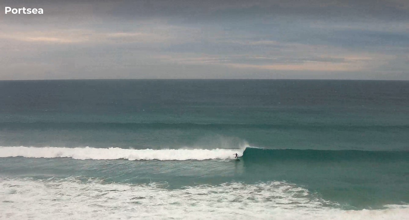
Easing short period waves on Thursday morning were accompanied by abating onshore winds, with a small long period groundswell built through the afternoon to 2-3ft west of Torquay. Size has slowly eased this morning from 2ft+ here, with bigger but wind affected waves east of Melbourne (though some parts of the MP have seen windows of workable conditions, per the image below from mid-morning).

Peninsula looking OK with a lone surfer this AM
This weekend (Jul 20 - 21)
I remain unconvinced as to the weekend’s surf potential, relative to the vigorous storm track in the Southern Ocean.
Right now the head of the storm track is pushing through the upper Bight, just north of Victoria’s western swell window - which itself is only favourable for major size at locations east of Melbourne. Anywhere west of Melbourne will see heavily attenuated wave heights thanks the shadowing effects of Cape Otway.
These are all valid considerations, given that local winds will remain gusty from the western quadrant both days. Strengthening W/NW winds tonight will swing gale force W’ly through the early/mid morning, tending SW around lunchtime. As such only early morning will offer a window of clean (if very blustery) conditions west of Torquay and with no major new groundswell in the water, surf size will be very small. Building windswells are expected in the lee of the change, and quality will be low.
East of Melbourne will be a write-off all day.
Sunday looks much better west of Torquay as winds straight back up from the NW as another front approaches from the west, and we should start to see some new W’ly swell push through Bass Strait, however I’m expecting much smaller size here relative to what we’ll see at the Cape Sorell buoy. 2ft sets early on, 3ft sets into the afternoon seems to be a reasonable ballpark given the low confidence under such a steeply west swell direction. Of course, there is potential for more size, but I'm just not game enough to go out on a limb as these westerly patterns more often fail to deliver, than surprise with unexpected size.
East of Melbourne will remain poor with not enough size for Western Port, and blown out conditions elsewhere.
Next week (Jul 22 onwards)
Still no major changes to the outlook for early next week.
Monday and Tuesday are looking best for the Surf Coast with fresh NW winds and building W/SW swells that should probably reach 3-4ft at most locations but may occasionally show bigger sets (5-6ft) at the regional swell magnets.
As discussed in Wednesday’s notes, the source of this energy is a large multi-centered low pressure system occupying the majority of the Southern Ocean below the continent, but it has a number of fetches that are disjointed, and its overall alignment is quite westerly which will limit surf surf size (compared to a system positioned closer to Tasmania, and with a better SW/NE alignment).
Wave heights will likely peak Monday afternoon (so, it may be undersized early) before easing slowly through Tuesday, levelling out in the 3ft+ range west of Torquay on Wednesday. Another pulse of W/SW swell will then fill in on Thursday afternoon, bumping up size back into the 3-4ft range for the afternoon and Friday.
In fact next weekend looks like it’ll maintain this wintry trend with similarly gusty NW conditions and moderate W/SW groundswells throughout the state. So, excluding this coming Sunday, that’s likely a full seven days of quality surf west from Melbourne to pick and choose from, though Monday and Tuesday will have the most size.
East of Melbourne should produce small waves inside Western Port at the peak of the swell Mon/Tues but will otherwise be undersized here for the rest of the forecast period, and a windblown mess elsewhere.
Have a great weekend!


Comments
7 days of quality surf ! What is that?
Something we're almost sick of on the East Coast.
Wash your mouth out.
Never!
Haha
To be fair, it's nice to have a few small days to rest the limbs, fix dings etc.
Go hard Benny!
It’s great at the moment because some people have a rest while others get great waves uncrowded.
The forecast of a week of mainly NW winds and swell is music to the ears of all Surf Coast surfers, Ben. Thanks.
Winter wonderland :)
All of the swell energy at Cape Sorell is (slightly) north of west, which explains the small, slow conditions in TQ this morning.
Was slow today but ended up having a very fun session on the SC. Some of the longboard comp contestants were out as well and wow seeing them in person is insane. The read they have on the waves is insane.
Good long fun sessions were there today, with the right board. AW
Also, how’s the cliff collapse in front of Jarosite? Must have happened in the last week - serious bit of dirt has moved.
looks real promising for the rest of the week