Average, tricky outlook continues
Victorian Surf Forecast by Craig Brokensha (issued Wednesday June 26th)
Best Days: Tomorrow for the keen on the Surf Coast, later Sunday protected spots
Features of the Forecast (tl;dr)
- Small, weak W/SW swell tomorrow with strong NW tending W/NW winds, easing Fri with strong N winds
- Inconsistent SW groundswell Sat with strong N-N/NW winds
- Tricky increase in swells Sun, more so later in the day with strong NW tending W/NW winds
- Peak in swell Mon AM then easing with strong SW winds
- Easing swell Tue with E-E/SE winds
Recap
Our tricky pulse of W’ly swell due through yesterday failed to really make any impact across the Surf Coast reefs with the exposed beaches picking up 2ft+ waves on the afternoon high tide. To the east we saw the swell kick to a stronger 4ft as cross-offshore winds created workable conditions.
This morning the swell has faded with 1-2ft leftover sets on the Surf Coast and 3-4ft waves to the east.

Full, small lines yesterday afternoon
This week and next (Jun 27 - Jul 5)
The best swell of the period has now come and gone unfortunately, with us now having to rely on flukey pulses of distant swell and then swell from another funky, mid-latitude low.
The remnants of the strong low in the Bight will move east across us tomorrow, bringing a weak fetch of W/SW winds and small pulse of energy to 2ft+ on the Surf Coast, 4ft to the east, easing Friday.
Conditions will be clean most of tomorrow with strong NW tending W/NW winds tomorrow, strengthening N on Friday as the swell eases.
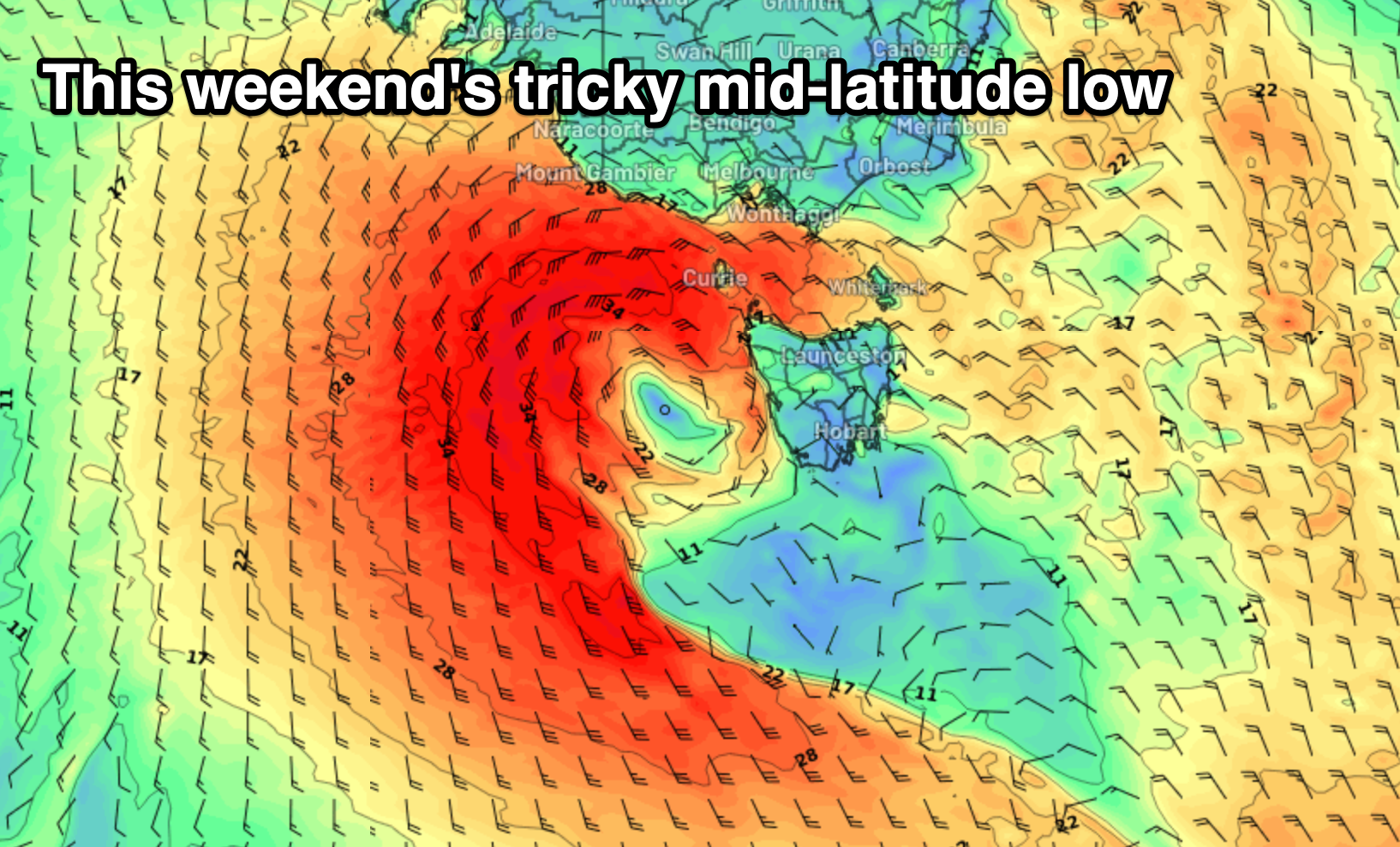
Saturday looks small with some background SW groundswell but as we move into Sunday, we’ve got another very tricky and dynamic low on the cards, with it moving in from the west over the coming days.
In Monday's outlook, the bulk of the swell generating fetch around the low was due to be aimed towards Western Australia, but now the low is due to form just west of us on Saturday, with a similar south to north angle compared to the last low, but positioned a bit more favourably in our swell window.
We’re expected to see a fetch of gale to severe-gale S’ly winds aimed into South Australia Saturday with weaker W winds around its northern flank in our swell window.

Come Sunday though the low is due to move up and into us while weakening bringing some localised windswell mixed in with mid-period energy for the afternoon/evening.
As the low moves in Sunday, winds will strengthen from the NW tending W/NW along with building levels of swell. The size is still tricky to nail down but we should see sets on the Surf Coast reaching 4ft later in the day, 6ft+ to the east, peaking Monday morning to 4-5ft and 6ft+ respectively.
This will unfortunately be with strong SW winds but we’ll have to look at this in more detail on Friday as there’s bound to be movement between where and when the low moves across us.
The swell from the low will ease quickly into next week as winds shift more E/SE-SE but we’ll review this Friday.
Longer term some good W/SW groundswell is due later week from a strong frontal progression through the Southern Ocean in our medium to far swell window, but check back Friday for more on this.


Comments
Are you really predicting 8 days of NE? Whoa it will on down here.
Hot tip re wind forecasts , cross check everything against Willy weather , historically I find their wind forecasts closest to the mark.