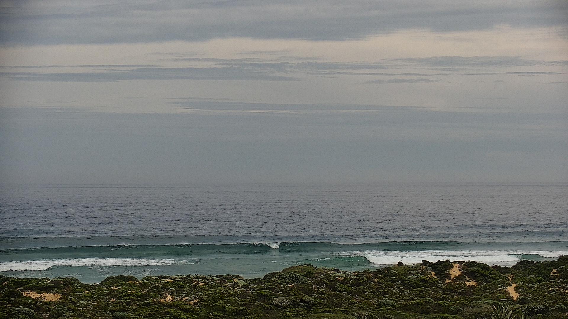
Complex weekend, blowy start to next week, but not a lot of love in general
Victorian Surf Forecast by Ben Matson (issued Friday 21st October)
Features of the Forecast (tl;dr)
- Easing swells on Saturday with average conditions (brief window of early variable winds)
- Sunday's looking complex but there is some potential for a window in the arvo
- Large local E/SE windswell Mon but with poor conditions, easing and improving Tues (best in the a'noon)
- Not much into the longer term
Recap
Thursday was generally average west of Melbourne under an easterly flow, though winds did ease through the afternoon and the 2-3ft or so of groundswell produced rideable waves at the open beaches. East of Melbourne was a foot or two bigger and clean. This morning saw stronger surf around 3ft west of Melbourne and 4-5ft east of Melbourne, with clean beachies under light to moderate NE winds.

Friday afternoon peaks across the Peninsula
This weekend (Oct 22 - 23)
It's a tricky weekend of waves ahead.
We’ve got a downwards trend from today into Saturday, and a temporary period of light variable winds at dawn ahead of a weak front that’ll clip the Torquay region between 8-10am (a little later east of Melbourne, a little earlier west from TQ). As such, you’ll need to aim for a dawn patrol for the best conditions, with easing 2ft sets at the Surf Coast’s open beaches, 3ft+ on the MP and PI. Once the wind kicks in conditions will become bumpy.
Small residual swells and lingering onshore winds are expected early Sunday, though we should see a kick in short range S’ly swell around lunch, sourced from a developing fetch off Tasmania’s West Coast overnight Saturday, that’s expected to nose just north of King Island.
This should build size into the 2-3ft range at most open beaches by the afternoon, and there’s actually a chance for a brief window of light variable winds from late morning through mid-afternoon, in response to a developing trough of low pressure that’s then expected to strengthen easterly gales across the region very late in the day (and then overnight).
Again, this is a low confidence event but we could see a short period of fun beaches across the region some time early Sunday afternoon. It's not worth too much time on the highway though.
For the record, a small SW groundswell is expected to push into the region on Sunday afternoon too, probably just a couple of feet in Torquay and 3-4ft east of Melbourne, sourced from a frontal passage below the continent over the coming days. No major energy is expected, though if we also see the new short range S’ly swell and the light local winds, it’ll contribute nicely to the mix at open beaches.
Next week (Oct 25 onwards)
Sunday’s late easterly wind will become strong to gale force overnight as a trough of low pressure squeezes against a high to the south. As such, Monday’s looking terrible for surf with conditions not expected to abate very much, if at all. The models are exaggerating wave heights for the Surf Coast; though regardless it’s expected to be large and unruly with howling onshore. Size should reach 4-5ft+ here, with smaller surf east of Melbourne thanks to the swell direction being perpendicular to this coast (there'll be some small leftover SW groundswell in the mix too).
On Tuesday, the trough will move south and winds should become light and variable, ahead of a late W’ly tendency. We’ll see slowly easing surf from 3ft in Torquay (possibly still up to 4ft along the western end of the Surf Coast), abating by a foot or so through the day - so there should be worthwhile options along the beach breaks, particularly in the afternoon.
Expect small clean surf east of Melbourne in the morning before the wind veers.
The rest of the week looks quite small, but with an unusual synoptic pattern reducing confidence in the outlook.
The trough responsible for Sunday’s easterly breeze is expected to form a broad closed low early next week, and then linger almost stationary in the Tasmanian region until the end of the week.
This is likely to maintain a westerly flow through Bass Strait through Wednesday, Thursday and Friday, but the fetch will probably extend only a short distance into the Southern Ocean, which will significantly impede swell potential for the our coastal stretch that can handle this wind direction (Torquay).
There's a chance that the westerly flow may broaden to the south and west (as is suggested by the EC model) later in the week and this could result in some small mid-range energy for the Surf Coast, but it's an outlier at this stage.
The other limiting factors of this synoptic set up is a secondary S/SE fetch on the low’s south-western flank that looks to be poorly aligned for our region, along with the broadscale diverting of the Southern Ocean storm track away from our primary swell window.
Long story short: not much on the cards for next week, until the regional block breaks down into the weekend. But lots can happen between now and then so let’s take a closer look on Monday.
Have a great weekend, see you then!


Comments
Any danger of Victoria getting a big clean swell anytime soon?
I miss Craig