Good swell inbound, though winds aren't ideal
Victoria Forecast by Craig Brokensha (issued Monday 2nd March)
Best Days: Beaches Wednesday mid-morning to early afternoon, Thursday morning
Recap
Well, what a weekend and run of surf! All this late summer swell was due to a strong node of the Long Wave Trough moving in from the west during last week.
This brought with it front after front through our swell window, with Friday's large SW groundswell easing in size Saturday under light morning offshore winds and weak sea breezes, reaching a temporary low point Sunday morning ahead of a secondary large, powerful pulse of S/SW groundswell.
This swell kicked the Surf Coast back to 6ft to occasionally 8ft and morning N/NE winds shifted straight offshore for the Surf Coast during the early afternoon ahead of a shallow change. Reports from right across the Victorian coast were of pumping large waves for those willing to take it on.
Today stronger onshore winds are in along with the easing S/SW groundswell, creating poor conditions in all but protected spots.

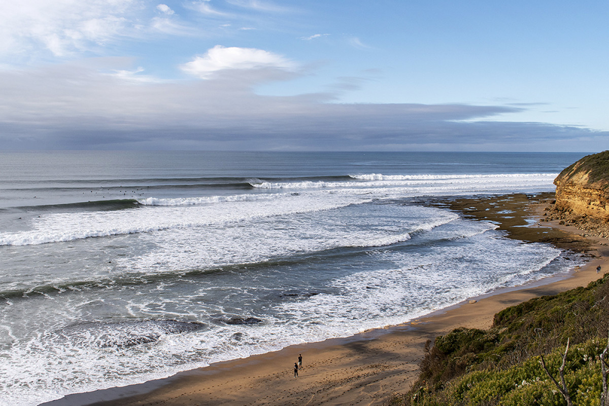
Bells perfection Saturday morning - Judy Scanlon
This week and weekend (Mar 3 - 8)
Moving into tomorrow and we'll see the S/SW swell continuing to drop in size from yesterday's large pulse of S/SW groundswell, with the period also dropping away. Onshore S/SW winds will create average conditions, though being only moderate in strength there should be some workable waves on the coast.
The Surf Coast should drop back to 3ft+, 4-5ft to the east, but into the afternoon a new S/SW groundswell should fill in, peaking Wednesday morning.
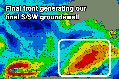
The swell was downgraded on Friday, but looking at the frontal system that's generating currently to our south-west, I've upgraded the expected size a little.
This frontal system will be the last under the influence of the Long Wave Trough through our swell window, with an elongated fetch of strong to gale-force SW winds projecting north-east towards Tasmania.
 This should generate a moderate to large sized S/SW groundswell, with a kick in size tomorrow afternoon and likely reaching 4ft by dark on the Surf Coast, 6ft to the east and peaking early Wednesday morning to 4-5ft and 6ft+ respectively, easing from then on through the rest of the day.
Winds will improve and tend E/NE through the morning Wednesday creating improving conditions across the beaches, not great at dawn. The swell will also be a bit big for exposed beaches, though a window as it eases and conditions remain clean is likely at midday.
Come Thursday variable winds are due across both coasts as the S/SW groundswell eases in size, back from 3ft on the sets across the Surf Coast magnets, 4ft+ to the east.
Friday will be poor as the swell bottoms out along with onshore SW-S/SW winds.
Unfortunately there's nothing decent due on the weekend with no quality swells inbound and onshore winds from the S/SW on Saturday, possibly E/SE Sunday morning but with no real swell for the beaches over 2ft.
Longer term a strong high moving in later this week and on the weekend will continue to keep the swell potential to a minimum.
A couple of polar fronts skirting around the southern flank of the high should generate some good S/SW groundswell mid-late next week with hopefully E/NE-NE winds, but we'll keep an eye on this over the coming updates.


Comments
Suss forey Craigos. no good mate, no good
I am watching for what happens later next week.
Here I am thinking you got your SC bias glasses on but that last paragraph gives me hope you got love for both!