Great waves tomorrow, large developments longer term
Victoria Forecast by Craig Brokensha (issued Monday 1st April)
Best Days: Tuesday, Wednesday morning exposed beaches, Thursday east of Melbourne, protected spots from early next week
Recap
A good increase in new SW groundswell Saturday with OK but not great conditions in protected spots, cleaner Sunday morning on the Surf Coast with easing sets from 3-4ft.
Today another SW groundswell has filled in, boosting wave heights back to 3-5ft on the Surf Coast with light winds and generally clean conditions, a bit better to the east with a more variable wind though lumpy and bumpy conditions.
Today’s Forecaster Notes are brought to you by Rip Curl
This week and weekend (Apr 2 - 7)
Today's new SW groundswell has peaked in size across Cape Sorell and from here we're due to see it easing off slowly while tending a little more S/SW in direction. This is due to the backside of the polar front linked to the swell producing a fetch of SW gales in our southern swell window before continuing east under Tassie.
The Surf Coast should still see 3ft+ sets on the swell magnets tomorrow morning with 3-5ft waves to the east along with favourable and local offshore winds (N/NW on the Surf Coast and N/NE on the Mornington Peninsula). Conditions are expected to remain clean into the early afternoon with an E'ly breeze on the cards into the late afternoon, though the beaches should remain smooth.
Wednesday will be workable on selected exposed beaches as the swell continues to ease under a morning N/NW breeze, though a surface trough moving through the afternoon will bring a S'ly change.
Size wise the Surf Coast will only be small and fading from 2ft, with 3ft sets on the Mornington Peninsula.
As touched on in Friday's notes, the front linked to Wednesday afternoon's weak S'ly change will produce a small fun pulse of W/SW swell for the beaches on Thursday as winds swing back around to the E-E/NE.
The swell will be produced by a small and quick burst of strong W/SW winds south of the Bight but there will be a slight intensification of SW gales directly south-west of us Wednesday evening.
 A mix of mid-period W/SW and SW energy to 2ft to possibly 3ft is expected on the Surf Coast Thursday morning, easing through the day with 3-4ft waves to the east, with possibly the odd 5ft set. Those easterly winds will favour the beaches through the morning, tending E/SE into the afternoon.
Friday will be great and offshore out of the N/NE all day but the swell small and fading from 1-2ft max on the Surf Coast and 2-3ft on the Mornington Peninsula.
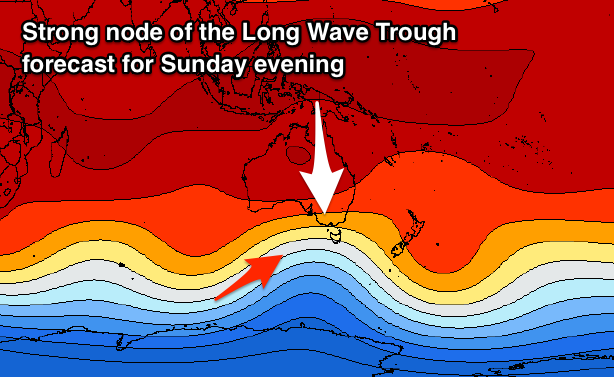
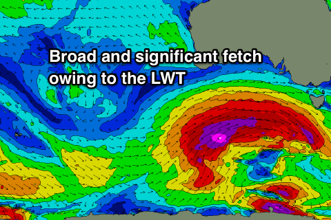
Of greater importance are the developments for early next week, with a strong node of the Long Wave Trough forecast to develop across WA later this week and then push east through the weekend and early next week.
 We can expect a significant Southern Ocean frontal progression, forming Friday south-west of WA and then broadening in scope and nearing closer through the weekend.
Saturday will start tiny with a possible small spike in acute W'ly swell late in the day, but more so Sunday, though into early next week we're looking at a very significant and large W/SW groundswell for later Monday/Tuesday.
At this stage we're looking at surf in the 6-8ft range across swell magnets on the Surf Coast and 10-12ft on the Mornington Peninsula under W/NW-SW winds. More on this swell event Wednesday though.


Comments
Hey Craig, swell direction today listed as 230 to 229 degrees... is that a normal one for here? How to say? - maybe like Borat "it is very niiice!"
Seeing as the buoy point is inside Bass Strait it's showing more west than true. It's actually more south than that and probably 215 or so at a guess. Our Cape Sorell forecast which is unimpeded is showing 223...
Interesting. I noticed what I reckoned was a better wrap around where I was, sections going through where often they don't. Was wondering if direction had changed a bit. About to bookmark direction, tide, size, etc for future reference!