Fun surf Saturday, onshore from Sunday
Victoria Forecast by Craig Brokensha (issued Friday 2nd March)
Best Days: Both coasts Saturday, east of Melbourne Tuesday and Wednesday mornings
Recap
Poor conditions with an increase in windswell and groundswell yesterday, much better this morning with lighter onshore winds from the E-SE across both coasts.
The swell was coming around 3ft on the Surf Coast, with 4-5ft sets to the east.
Today’s Forecaster Notes are brought to you by Rip Curl
This weekend and next week (Mar 3 - 9)
Today's SW swell was generated by broad but relatively weak frontal activity moving in from the south-east Indian Ocean earlier this week.
Some slightly longer-period but less consistent groundswell will fill in overnight and peak tomorrow morning, generated by stronger more distant fetches around the Heard Island region last weekend.
This should keep infrequent 3ft sets hitting magnets on the Surf Coast Saturday morning, easing through the day, with 4-5ft sets on the Mornington Peninsula.
Conditions are still looking great most of the day for select locations with a N/NE breeze on the Mornington Peninsula all morning, tending W'ly at some stage through the afternoon.
 The Surf Coast should see dawn N/NE winds, tending NW through the morning and then W/NW ahead of a late afternoon W/SW change.
This change will then linger into Sunday with fresh SW tending S/SW winds with small leftover levels of swell.
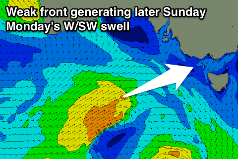
Into the afternoon though, a mid-period increase in W/SW swell is due, with a slight upgrade seen since Wednesday.
A persistent fetch of strong W/SW winds that's developed south of WA will project east-northeast towards us, with a late afternoon increase in size due Sunday, peaking overnight and easing slowly Monday.
The Surf Coast should build to 2-3ft, with 4-5ft sets on the Mornington Peninsula, easing from a similar size Monday morning.
Winds on Monday will remain poor though and moderate to fresh from the S/SW, and then SE-E/SE winds on Tuesday as the swell continues to ease.
Wednesday should be cleaner with light N'ly winds developing through the morning but there'll be no size left across the Surf Coast, with a SE windswell to 1-2ft, while the Mornington Peninsula may see 2ft to occasionally 3ft sets.
No major surf is due into the end of the week as a blocking high sitting to our south-west deflects a couple of strong polar storms away from us.
We may see a small S/SW groundswell pulse late week, but some better swell is due into the following week, more on this Monday. Have a great weekend!

