Fun swell building late week, easing through the weekend
Victoria Forecast by Craig Brokensha (issued Wednesday 13th December)
Best Days: Both coasts mid-late morning Friday until sea breezes hit, Surf Coast Saturday morning, beaches east of Melbourne Monday morning
Recap
Fun easing 2-3ft sets across the Surf Coast yesterday morning with a variable wind and 3-5ft sets on the Mornington Peninsula, best mid-late morning before sea breezes kicked in.
This morning we're back to a small leftover 2-3ft of swell on the Mornington Peninsula and 1-2ft sets at magnets on the Surf Coast (1-1.5ft most breaks). Conditions will be clean all day on the beaches with a hot northerly breeze.
Today’s Forecaster Notes are brought to you by Rip Curl
This week and weekend (Dec 14 – 17)
Give the surf a miss tomorrow as the swell will bottom out and winds from the western quadrant won't leave any decent surfing options at all.
 Moving into Friday though we'll see clean conditions across all locations with a variable wind as a new mid-period W/SW swell starts to build.
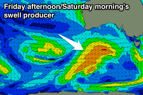
There are actually a couple of swells due to arrive at the same time, generated by the same slow moving frontal system through our swell window.
This system is currently south of WA and has generated a small and distant W/SW swell, but a stronger front spawning off the progression will project a good fetch of strong W/SW winds towards us this afternoon and tomorrow.
A fun W/SW swell should be generated, filling in through Friday and reaching 3ft on the Surf Coast into the mid-late afternoon with 4-6ft sets on the Mornington Peninsula. As the swell peaks though sea breezes will be creating bumpy conditions.
The swell is expected to drop from a similar size across both coasts Saturday morning as a morning W/NW breeze favours the Surf Coast ahead of sea breezes.
A small reinforcing W/SW swell is due into Sunday, produced by a weak fetch of pre-frontal W/NW winds sliding in on the back of initial front projecting towards us, followed by weaker W/SW winds in our south-western swell window.
 This will just delay the easing trend, with a slow drop in size from 2-3ft at magnets on the Surf Coast Sunday, with 4-5ft sets on the Mornington Peninsula, smaller Monday.
GFS outperformed EC in this outlook, with the later forecasting a stronger secondary front on Monday, and with the weaker follow up season, we're set to see winds swing around to the SE Sunday and E Monday as a high ridges in.
This isn't ideal, with Monday morning likely providing the best waves across the beaches to the east.
Longer term the outlook is quite interesting and dynamic.
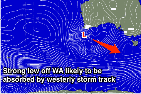
Over near WA a cold front projecting up into the South West will combine with an inland surface trough resulting in the formation of a deep and powerful mid-latitude low.
This low will stall over WA Sunday and Monday before weakening and starting to drift south-east through early next week. As this low moves into the Southern Ocean, an injection of cold air looks to cause the system to restrengthen, producing swell mid-late next week. Check back here Friday for an update on how this scenario is evolving.

