Mixed weekend, much more active from next Thursday
Victoria Forecast by Craig Brokensha (issued Friday 4th Jul)
Best Days: Saturday morning and Sunday morning Surf Coast, Monday and Tuesday afternoon east of Melbourne, Thursday Surf Coast
Recap
Wednesday's swell dropped back as expected across the region, with fun 2ft+ waves around Torquay and some nice 3ft sets at 13th Beach under all day offshores, while the Mornington Peninsula offered great waves with 3-5ft of swell.
Today small waves have continued in the 2ft range across the Surf Coast while the Mornington Peninsula was in the 4ft range but tricky with a strong N'ly wind. Winds should swing more N/NW through the afternoon as the swell stays around the same size.
This weekend (Jul 5 - 6)
Last update I played down the westerly swell expected off a cut-off low moving in from the Bight and across us tomorrow. The system was forecast to sit too high and mainly out of our swell window, and the forecast models seemed to be having trouble picking this up as well.
Latest updates however have the mid-latitude system a touch further south, and a touch more in our swell window. This will result in a bit more size across the region through tomorrow, but I still think it will be under the model forecasts of 4ft or so around Torquay.
Instead, we're probably looking at 3ft sets max across the Surf Coast as the swell peaks through the day. Early it's only likely to be 2-3ft and with W/NW winds it'll be worth a surf before a W/SW change moves through during the arvo.
The Mornington Peninsula should be larger and in the 6ft range but terrible with the westerly breezes.
The swell will disappear overnight Saturday as the low breaks down leaving much smaller 2ft leftovers on the Surf Coast and 4ft waves on the Mornington Peninsula under lighter W/NW tending W/SW winds.
Next Monday onwards (Jul 7 onwards)
As mentioned last update, there's nothing too major on the cards for the start of next week, with even smaller leftovers Monday under N'ly winds, favouring the Mornington Peninsula.
A slight increase in long-range W/SW groundswell from the Indian Ocean is due Tuesday afternoon, but this will be extremely inconsistent and isn't likely to top 2ft+ on the Surf Coast and 3-5ft on the Mornington Peninsula. Strong N'ly winds will favour exposed locations across both coasts, but conditions will be tricky and quite blowy.
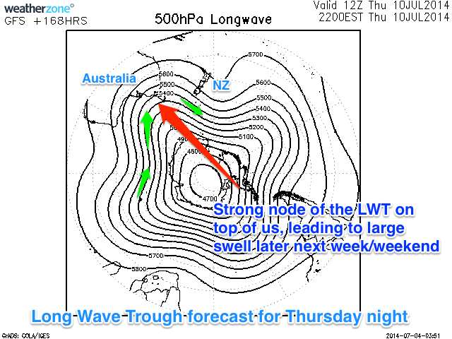
The more interesting developments take place into the second half of next week as the Long Wave Trough moves across the south of the country, bringing with it a series of vigorous polar fronts and solid swells.
Initially as the LWT focusses over WA, a very strong and powerful polar front will push up from the Heard Island region, up and into WA, generating a medium to large sized W/SW groundswell for us on Thursday.

This swell should offer inconsistent but good 3ft+ sets on the Surf Coast (up to 4ft at 13th Beach) with larger 6ft to occasionally 8ft sets on the Mornington Peninsula. Strong N/NW tending W/NW winds will favour the Surf Coast, although this may change as the models are shifting around a touch on the secondary system pushing in later in the week.
As the LWT moves through the Bight and over us into the second half of next week, we'll see the polar frontal activity directed more towards us and with this we're expected to see a large and powerful SW groundswell event later in the week and into next weekend.
More on this in Monday's update though. Have a great weekend!

