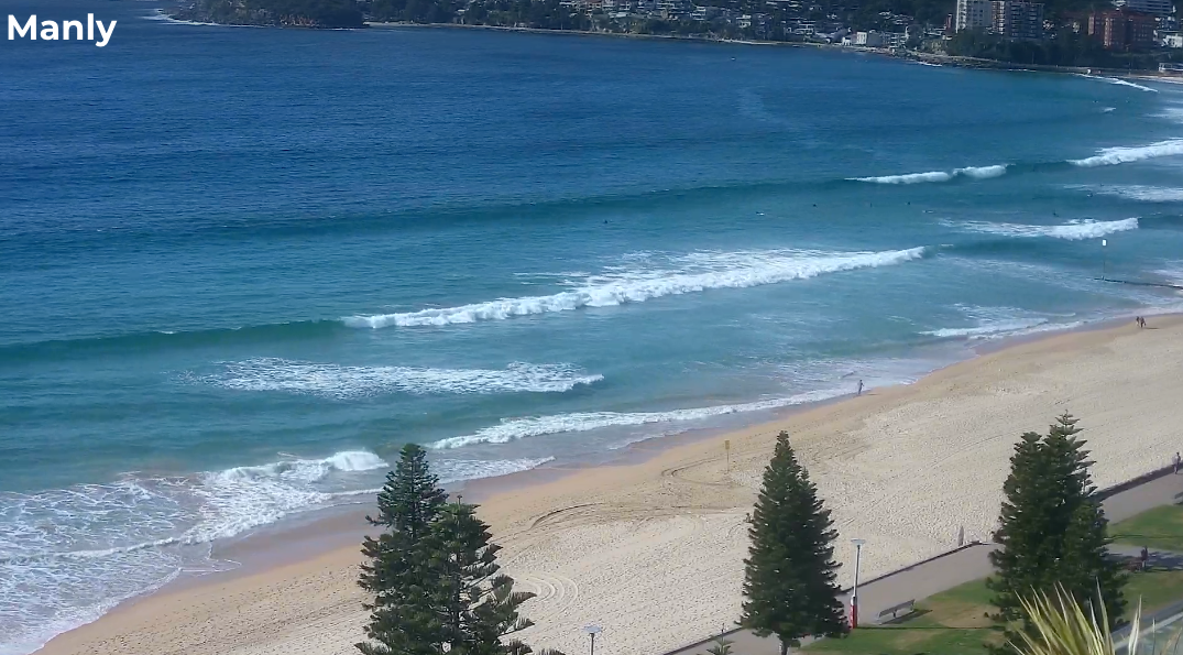
Intermittent south swells for the next few days
Sydney Hunter Illawarra Surf Forecast by Ben Matson (issued Wed Mar 27th)
Features of the Forecast (tl;dr)
- Small southerly swells Thurs, though winds may linger onshore
- Size bumping up a touch Fri from the south with light winds
- A little more S'ly energy Sat, hopefully persisting Sun, though low confidence (both days light winds)
- Small surf early next week
- Fun peaky NE swell Tues/Wed, the latter potentially with a NW wind change
- More S'ly swell on tap for later next week
Recap
S’ly swell built to 3-5ft across south facing beaches on Tuesday, easing slightly into today, and conditions were bumpy on Tuesday with fresh south winds, similar today, creating problems at exposed spots.

Plenty of south swell getting into the beaches this morning
This week (Mar 28-29)
Weak coastal troughiness will contract to the North Coast on Thursday though lingering onshore SE winds are a risk north from Sydney. They probably won’t be too strong, so conditions should improve from this afternoon, but keep it in mind when choosing somewhere to surf.
Wave heights will throttle back in size from today, down to a slower 2ft+ at south facing beaches with smaller options elsewhere. Size will probably ease a smidge into the afternoon.
Friday is likely to offer small waves through the early morning, though we have some new southerly swell expected to build through the day, sourced from a strong front pushing up below Tasmania into the lower Tasman Sea today.
Initially we’ll see mid-period energy show by lunchtime, that should offer 2-3ft sets at south facing beaches into the afternoon (smaller elsewhere) but longer period energy is due to arrive very late in the day and we may see some bigger sets right on dark (mainly the reliable swell magnets and the Hunter). Conditions should remain clean with generally light variable winds.
This weekend (Mar 30-31)
The bulk of this new longer period south swell will fill in on Saturday, so we’ll see a mix of swells offering sets in the 2-3ft range at south facing beaches with smaller surf elsewhere. No major wind strength is expected under a slack synoptic gradient so conditions should be clean.
A slight easing is expected into Sunday morning with similarly light variable winds. Wide open beaches with good southerly exposure will be your best option for a surf again. A couple of long period south swells (one from the S/SW, the other from the S/SE) are expected to fill in during the day though I’m not confident on size prospects.
The best looking swell will have originated from a deep polar low well to the south of New Zealand today, but the fetch length is short and the low hasn’t spent a lot of time in our swell window. As such I’m keeping a lid on size expectations, hopefully we’ll see some stray 2-3ft sets at south swell magnets later in the day, but it’s a low confidence event so don’t plan any highway miles.
Next week (Apr 1 onwards)
Small swells from the southern quadrant will persist into the start of next week, with generally light winds gradually swinging to the NE as an inland trough develops across the eastern states.
These NE winds will strengthen into Tuesday, generating a peaky NE swell that should produce some nice 3ft sets by the afternoon; size should hold into Wednesday, by which time we should see a fresh NW change as a low pressure deepens near eastern Bass Strait.
As such there’s likely to be a window of fun peaky NE swell across the region at some point early mid-next week but we’ll need a few days to tie up the specifics.
Strong southerly swells are a distinct possibility for the second half of the week, once this low clears to the east - though the models are not really confident on a solution at the moment, so let’s take a closer look in Friday’s update.
See you then!

