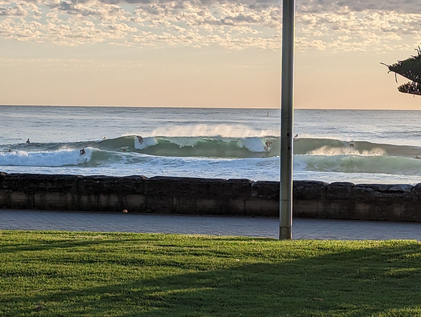
Fun weekend of waves ahead
Sydney Hunter Illawarra Surf Forecast by Ben Matson (issued Fri 3rd Feb)
Forecast Summary (tl;dr)
- Fun waves at the open beaches with small mix of swells Sat with offshore winds
- Interesting S'ly swell for Sun with light varibale winds
- Small mix of swells for most of next week too, generally good winds
- Occasional southerly pulses will show periodic bigger surf at south swell magnets (Thurs the pick right now)
- Lots of dynamic options for the long term
Recap
Fun mix of peaky swells over the last few days with sets building to 2-3ft on Thursday at exposed beaches, with 3ft+ sets on offer today, swell direction NE and E. Clean mornings with light winds before afternoon NE breezes cropped up Thursday afternoon, and SE winds kicked in this afternoon.

This weekend (Feb 4-5)
Local conditions are looking pretty good for most of the weekend.
Today’s shallow southerly change should clear to the north, allowing westerlies to develop across most regions on Saturday morning. This will create smooth conditions.
We’ll continue to see a mix of swells on Saturday, mainly from the eastern quadrant though a complex trough well offshore from Northern NSW could throw a few interesting curveballs into the mix. Overall I’m expecting fun though slow 2-3ft sets, however wind strengths around the trough are capable of generating larger waves. However, this trough is tracking south-east, perpendicular to the swell window, so confidence is low for these bigger sets.
Elsewhere, and today a deep cut-off low pressure system is circumnavigating the Apple Isle (counter clockwise), and by Saturday afternoon we’ll see W/SW gales exiting eastern Bass Strait.
This is one of my favourite flukey south swell windows, and this time around I reckon there’s just enough south in the westerly fetch alignment to allow for a spread of acute south swell up the Southern NSW Coast on Sunday.
This looks to be a morning event (easing a smidge into Sunday afternoon) and I’ll peg south facing beaches in the 3ft range, with 3-4ft+ sets across the Hunter stretch, even if only for an hour or so. These swells are very tricky so make the most of what you can. Often it's the case that the South Coast doesn't pick up these steep south swells very well either, so keep your expectations a little lower, south of Sydney.
Also, we won’t see this energy influence anywhere else, so remaining beaches will be relying on leftover E’ly swell.
Conditions look clean with generally light winds and sea breezes.
Next week (Feb 6 onwards)
There’s a myriad of swell sources for next week.
However, our north-eastern window - whilst active - probably won’t produce much size at first.
A complex trough tracking west from a position north of Fiji over the weekend may slowly develop into a tropical low, west of Vanuatu mid next week. If anywhere, the early stages of this development will only benefit Northern NSW and SE Qld, and right now is way too far out to glean anything from the long range models (which are spruiking a range of interesting tropical options).
Nevertheless, the take home message for this neck of the woods is: watch this space. It's gonna get interesting up north.
Elsewhere, a secondary Southern Ocean cut-off low (associated with the weekend’s low around Tasmania) forming further south - closer to the SW tip of NZ, on Sunday - will maintain low confidence sideband south swell for Monday and Tuesday.
A broader but ultimately weaker frontal passage much further south on Monday will then generate small to moderate southerly swells for south facing beaches through the second half of the week. Wave heights could reach 3ft at reliable spots though it’ll ebb and flow over the course of several days. Later Wednesday and Thursday are looking the best at this stage, though there'll be waves either side.
Overall, there’ll be waves at the open beaches most days but most locations will probably remain on the smaller side of the coin.
An unstable atmospheric setup will dominate the eastern seaboard for much of next week so there’s a good chance we’ll see some dynamic upgrades in the surf outlook by the time Monday’s model runs come around. So, expect some more exciting discussion points early next week.
Have a great weekend!


Comments
Repeat of the morning will be much appreciated.. maybe a touch more energy forecast fingers crossed ..
Probably not as this morning's secret ingredient was the NE windswell. Expect straighter surf tomorrow and slower.
On the money Craig very slow this morning
Arvo was definitely pretty fun - plenty of 2-3ft surf and offshore
Yep. Late pumped. I'm ruined but soo content.
Yea barely 2 foot and slo-mo. How's this guys view from yesty arvo?
Steve reckon Illawarra might see some south swell in the morning?
The Illawarra definitely saw some swell. Just got out. Great size at the local, at least compared to first light.
Nice to see.. been a slow builder thus far.
On a trip south. Far South South has been quite nice indeed! East swell . Warm water and offshore!
Sth swell def hit nthern beaches magnet. Tracked it from Eden last night and timed it to perfection! Was a load of grovellers on the dregs of the east swell before boom! Decent size for an hour then the winds stuffed it and it faded.. hardly anyone on the sets till the word got around!
Unreal.. how big?
3-4 ft but good power.