Average period of surf ahead; Sunday the biggest
Sydney, Hunter and Illawarra Surf Forecast by Ben Matson (issued Wednesday 12th September)
Best Days: Thurs/Fri/Sat: small small mix of peaky swells with periods of OK winds. Sun: building S'ly swell, though conditions won't be great (best early, though wave heights may be a little undersized).
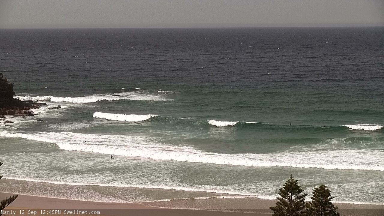
Recap: A brief window of early light winds on Tuesday morning accompanied 2-3ft of easing S’ly swell that arrived late Monday. The freshening nor’easter generated a fresh NE swell that reached 2-3ft into the afternoon and has persisted at this range into this morning. We're also seeing some small underlying distant E'ly groundswell in the mix, and I reckon there are some SE lines on offer too, from the secondary fetch in the Tasman Sea (see surfcam image below). Local winds have eased from the north though there’s still some wobble through the lineup.

Typical wobbly set at Queenscliff this afternoon. Looks pretty SE to me, whaddya think?
This week (Sep 13 - 14)
Today’s Forecaster Notes are brought to you by Rip Curl
A trough sliding up the coast this afternoon is a bit of an annoyance. It’s both disrupting the northerly fetch generating our local swell (which will lead to a drop in size through Thursday and Friday), and is also steering the Southern Ocean storm track away from our south swell window. It’s also not bringing any local southerly swell either.
We’ll see light variable winds develop on Thursday (there may be a trailing S/SW breeze early morning) but swell sources will consist of small leftovers out of the NE, and some infrequent long range E’ly swell. I’ll be surprised if there’s anything bigger than 2ft+ at reliable swell magnets early, with slightly smaller surf expected throughout the day.
Similarly small surf is expected on Friday though we’ll see the NE breeze strengthen throughout the afternoon and this may generate some small wind waves late in the day. It’s not worth getting too excited about though.
This weekend (Sep 15 - 16)
Small leftover NE windswell will occupy most of Saturday morning though it won’t be very large, offering occasional 2ft+ sets at exposed NE facing beaches. Winds should freshen from the N/NW ahead of a late W’ly change (at strength) but there won’t be a lot of options at south facing beaches (that’ll handle the morning wind the best). Still, it’l be rideable if you’re super keen.
A vigorous front rounding the Tasmanian corner on Saturday - associated with Sydney’s afternoon’s W’ly change - will spear up the coast overnight Saturday and build S’ly swells into Sunday. Winds will remain out of the southern quadrant but should be SW early, even WSW across some locations (like the Northern Beaches).
South facing beaches should see a peak around 4ft at some stage though surf size will be much smaller at locations not facing due south. The Hunter should pick up a few bigger sets though.
Next week (Sep 17 onwards)
There’s still nothing of any great interest modelled for the Tasman Sea into the longer term, however model guidance is suggesting a building phase of activity through the South Pacific that should bring about a period of extended, if perhaps only small to moderate (at best) E/NE swell, arriving through the second half of next week and holding into the weekend. Let’s see if Friday’s model runs are holding true.


Comments
Worst year of surf in memory
Can only agree. ..” ..the devil makes work for idle surfers”
South swell at .9m on buoys albeit at 7 seconds
I concur, another poor year of surf..