Cracking weekend of south swell in Southern NSW
Sydney, Hunter and Illawarra Surf Forecast by Ben Matson (issued Friday 9th December)
Sign up to Swellnet’s newsletter and receive the Sydney/Hunter/Illawarra Forecaster Notes and latest news sent directly to your inbox. Upon signup you'll also enter the draw to win a surf trip to P-Pass for you and a mate. It doesn’t get much easier so click HERE to sign up now.
Best Days: Sat/Sun: strong S'ly swell, good winds early. Mon: rapidly easing S'ly swell, get in early for the most size and best conditions. Late Thurs and (more likely) Fri: strong S'ly swell.
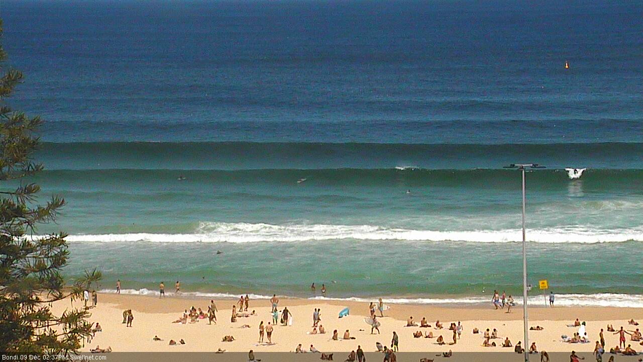
Recap: Thursday started off small across the Sydney region, but a NE windswell built into the 3ft+ range right on dark at a few exposed NE swell magnets. This swell eased rapidly overnight, leaving clean 1-2ft waves with moderate offshore winds, however from lunchtime onwards we’ve seen a building south swell that’s now starting to push the 3-4ft range as expected (interestingly, Wednesday’s forecast notes suggested 3-4ft against the model’s prediction of 3ft, and now the model has come into line, predicting 3-4ft by 6pm this evening). Conditions have been clean at most locations all day though a moderate SE breeze just nosed into Wollongong, Cronulla and Maroubra.

Strong S'ly lines filling into Bondi this afternoon
This weekend (Dec 10th - 11th)
No changes to the weekend forecast. We’ve got plenty of south swell on the way and winds should be light early morning, creating clean conditions at most beaches.
These swells will originate from a broad area of S/SW gales just to the east of Tasmania, around the western flank of the parent low to the front responsible for today’s initial S’ly pulse.
Saturday morning will probably see a period between swells, that is easing energy from today but with a rebuilding trend as the new energy pushes through. A peak in size is then expected through Saturday afternoon and maybe first thing Sunday morning before size then dips eases into Sunday afternoon.
At the height of the swell south facing beaches should be somewhere in the 4-6ft range, with the upper end of this more likely at offshore bombies and the like (maybe even a few bigger sets if we're lucky). The Hunter always rakes in these south swells a little more efficiently so easy 6ft+ bombs are likely here through the weekend.
No major strength is expected in the wind each day though we will see afternoon sea breezes from the north-east. So if you had only one window to pick this weekend, and wanted to maximise your size, Sunday morning is probably the best (as Saturday afternoon will see NE breezes as the swell peaks). Though there should be great options Saturday morning too.
As always, expect smaller surf at beaches not completely open to the south.
Next week (Dec 12th onwards)
The first half of next week is looking a little quiet.
Monday will start off with easing swell from Sunday, still some 2-3ft+ sets at exposed south swell magnets though more likely across the Hunter than anywhere else - and easing steadily throughout the day. Expect smaller waves elsewhere, and tiny surf at beaches with less southerly exposure. Freshening NE winds throughout the day will confine the best waves to sheltered northern corners.
Late afternoon, a small reinforcing S’ly pulse will reach the South Coast from a poorly aligned but otherwise modest SW fetch through the Southern Ocean. This should provide some inconsistent 1-2ft sets through Tuesday but only to south swell magnets.
Freshening NE winds late Monday may also whip up a small, weak NE windswell for Tuesday but no great size is expected. A similar pattern of northerly quadrant winds through the day (with an early nor’west period) should contribute small NE windswell through Wednesday as well. Thursday could see this trend repeat thanks to a stationary mid-week N'ly fetch off the Mid North Coast.
Around this time, the models are suggesting a deep Southern Ocean low will move under Tasmania, setting up a solid, long period S’ly swell for the end of the week. It’s way too early to get excited but there are suggestions that late Thursday (South Coast) and Friday (entire Southern NSW coast) could see some great waves around the 4-5ft range at south facing beaches.
I’ll also be keeping an eye on a local trough around the Southern NSW region on Thursday that has the potential to develop into a more significant swell generating system.
And, the tropics will be starting to develop some early season trade swell through the week - it's not yet looking to be favourable for our next of the woods but will require regular re-evelation through the working week.
Anyway, let’s wait and see how Monday’s model runs hold out.
‘Till then have a great weekend!

