New south swell Thursday; freshening N'ly winds Friday; super fun NE swell for Saturday
Sydney, Hunter and Illawarra Surf Forecast by Ben Matson (issued Wednesday 7th September)
Best Days: Thurs: inconsistent but fun south swell at beaches with shelter from N'ly winds. Sat: great short range NE swell with offshore winds, easing during the day. Sun: small clean combo of new S'ly swell and minor easing NE swell.
Recap: No major surf for the last few days, just a slow inconsistent south swell at exposed beaches with generally light winds.

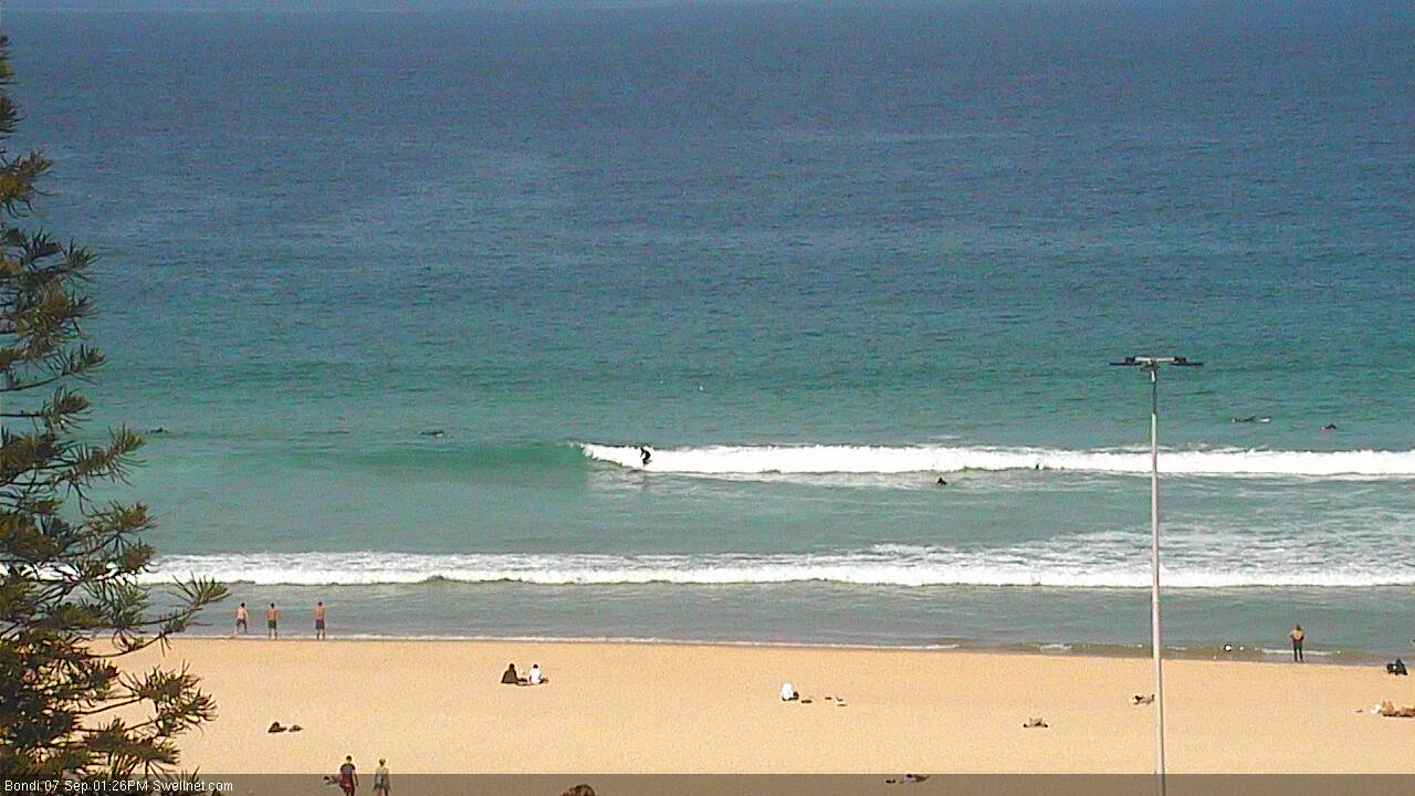
Small clean southerly lines at Bondi this afternoon
This week (Thursday 8th - Friday 9th)
Nothing of major interest expected for the next couple of days.
However the models have stalled the late Friday W’ly change (as suggested in Monday’s notes) which has very good implications for the start of the weekend (I'll get to that in a minute).
Thursday will see generally freshening N’ly winds, before they become quite gusty on Friday. As such only protected northern corners will have workable conditions over the coming days.
Another small pulse of long period S’ly swell is expected in the water early Thursday morning, originating from the tail end of the same broad frontal progression that has generated the last few days of minor southerly swells.
However, this last fetch looks slightly better aligned - sure, the front tracked across the south-eastern Tasman Sea, outside of our swell window, and at speed too - but it displayed a slightly more meridional alignment than the previous fronts, which means it'll spread back into the coast a little better. Core winds speeds were a little stronger too (50kts) and we’re therefore expecting slightly higher peak swell periods.
That being said I don’t want to overestimate potential wave heights from this swell as it’s a flukey part of our swell window and Southern NSW will only see small levels of energy glancing the coastal margin. However, we’re seeing decent 2ft sets across south facing beaches today and this should definitely punch a little higher tomorrow.
I think occasional 2-3ft sets is a reasonable call for south facing beaches on Thursday; set waves will be rather inconsistent but all of the available data points towards some really nice straight lines across the region. Keep in mind that beaches not directly open to the south will be much smaller (however Newcastle should see a few bigger bombs).
On Friday, the south swell will be but a distant memory and we’ll see building short range NE swells from the local strengthening fetch. Quality won’t be great but NE facing beaches should pick up 3ft+ sets by the end of the day (biggest surf right on dark, smaller prior to this). Expect smaller surf at south facing beaches.
This weekend (Saturday 10th - Sunday 11th)
It looks like local winds will veer NW overnight Friday then fresh W’ly just before dawn on Saturday. Fortunately, model guidance maintains strong to gale force N/NE winds within our immediate swell window until the change arrives, which means we should see some great waves for the early session on Saturday.
At this stage - if nothing changes over the coming days of model output - Saturday morning should see 3-4ft sets at NE facing beaches across the Sydney region, ahead of a steady decline in size throughout the day. There may be a slight early wobble from the overnight N’ly flow but it’ll be certainly on the improve from the get-go and I wouldn’t be surprised if surf conditions are really good for the entire day. But it'll definitely be biggest early morning.
As for other regions in Southern NSW - as you head north towards Newcastle, surf size will start to become smaller (due to the shadowing effects of the Hunter curve) but conversely, the South Coast can expect bigger surf owing to a longer fetch length (early 4-5ft+ sets at NE swell magnets).
Also, please remember that beaches not open to the north-east (hello, Cronulla!) will see smaller wave heights from this source.
Sunday looks pretty fun as well with a small building south swell thanks to a minor low forming east of Bass Strait (behind Friday night’s front). This should kick up 2-3ft of south swell for south facing beaches on Sunday and local conditions are looking super clean with light offshore winds and afternoon sea breezes. Beaches not open to the south will however be smaller with a mix of S’ly and trailing NE swell in the 1-2ft range.
Next week (Monday 12th onwards)
Continuing strong frontal passages through the Southern Ocean and lower Tasman Sea next week will produce small to moderate long period S’ly swell for several days. No major size is expected but we can expect surf size to occasionally pulse intermittently in the 2-3ft range from late Monday (more likely Tuesday) all the way through Friday.
Also, the long range models are suggesting we’ll see an unstable troughy pattern off the South Coast early next week, which - whilst not showing any major signs just yet - could lead to the evolution of a more significant swell producing system within our near swell window, around mid-week. More on this in Friday’s update.


Comments
The new southerly groundswell looks to be providing 3ft sets. But very very inconsistent.
Just got back from a surf and the swell has filled in. Inconsistent but good 3ft sets across south facing beaches.
Looking pretty solid in Newcastle this afternoon. Shame about the wind.