Fun small swells ahead
Southern Tasmanian forecast by Craig Brokensha (issued Wednesday January 29th)
Best Days: Tomorrow morning, dawn Sunday, Monday morning
Features of the Forecast (tl;dr)
- Easing swell tomorrow with variable offshore winds ahead of relatively weak sea breezes
- Tiny Fri with variable offshore winds ahead of stronger SE sea breezes
- Mix of tiny W/SW groundswell and better mid-period W/SW swell for the PM Sat, easing Sun
- Light-mod NE tending stronger E/NE winds Sat
- Dawn N/NW tending S winds by mid-AM Sun, freshening
- New W/SW groundswell Mon with N/NE tending E/NE winds
Recap
Yesterday started clean and tiny, with winds shifting through the day ahead of a late pulse of new swell.
The swell has peaked through today though with 2ft+ waves across Clifton under early offshore winds which have now given into sea breezes.
This week and weekend (Jan 30 - Feb 2)
The frontal progression linked to today’s swell has cleared off to the east and with this we’ll see the surf easing back from 2ft on the sets across Clifton tomorrow, tiny into Friday.
Winds should be variable offshore tomorrow morning ahead of relatively weak sea breezes with Friday playing out similar in the morning head of a stronger SE’ly into the afternoon.
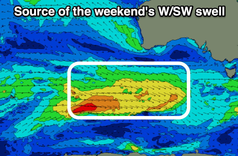
Into the weekend a mix of tiny, long-range W/SW groundswell and closer-range mid-period W/SW swell are due to fill in, with the closer-range energy expected to peak through the afternoon Saturday before easing Sunday.

The long-range energy was generated by a small, tight and distant polar low earlier this week in the Heard Island region, with the close-range energy produced by a secondary weak frontal progression that’s currently passing under the Bight, west-southwest of us.
The morning looks to come in at 1-1.5fft with building sets to a more consistent 2ft due into the afternoon Saturday, easing from 2ft on Sunday.
Local winds on Saturday aren’t ideal with a light to moderate NE’ly due to strengthen out of the E/NE through the day with Sunday seeing dawn N/NW winds, but a trough may bring a S’ly change by mid-morning (only weak).
Monday looks better with a N/NE offshore and new pulse of W/SW groundswell due to be in the water, produced by a tight but strong low forming just west of us on the weekend.
A quick burst of W/SW gales should produce 2ft+ waves but we’ll have to confirm this on Friday as any change to the intensity of timing will result in changes to the size and winds.

