Make the most of the current swell
Southern Tasmanian Forecast by Craig Brokensha (issued Monday October 14th)
Best Days: Tomorrow
Features of the Forecast (tl;dr)
- Moderate + sized S/SW groundswell building this afternoon/evening, easing steadily tomorrow with moderate N tending strong E/NE-NE winds
- Tiny, fading swell Wed with strong N/NE tending E/NE-NE winds
- Tiny, inconsistent W/SW groundswell Thu with W/SW-SW tending S/SE winds
Recap
A strong mix of swells provided a good spike in swell to 3-4ft on Saturday morning with clean conditions, easing back from 2-3ft yesterday.
Today started tiny with onshore winds which have since strengthened further along with some building S/SW groundswell. More on this below.
This week and weekend (Oct 15 - 20)
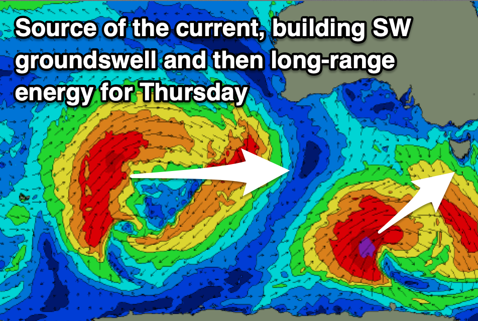
The SW tending SW tending S/SW groundswell due into today has been upgraded since Friday owing to the low generating it forming a little earlier than predicted and coming in stronger.
A great fetch of gale to severe-gale SW-S/SW winds were aimed up towards us, with the swell due to reach an easy 4-5ft later today, easing back tomorrow from 3-4ft.
The easing trend will be quite steady and we’ll see morning N’ly winds shifting E/NE-NE into the afternoon while strengthening.

Wednesday looks tiny along with strong N/NE tending E/NE-NE winds into the afternoon.
As touched on last update, the rest of the outlook is slow with swells arriving from afar and coming in west. The best one is likely on Thursday, though it was generated in the Southern Ocean south of the Indian Ocean and sat mostly north of our swell window.
We may see 1-1.5ft sets from this source though inconsistent and with dicey W/SW-SW tending S/SE winds as a trough lingers in the region.
This isn’t really a day to plan around surf wise so make the most of tomorrow.
Longer term there’s nothing really of note but check back here on Wednesday.

