Building surf later week, peaking Saturday
Southern Tasmanian Forecast by Craig Brokensha (issued Wednesday October 9th)
Best Days: Friday morning, Saturday morning, Sunday morning, Tuesday morning selected spots
Features of the Forecast (tl;dr)
- Tiny Thu AM ahead of a late increase in W'ly swell with strong W tending strong W/SW winds
- Small W/SW swell Fri AM with N/NW tending strong W winds
- Late increase in W/SW and SW swells Fri, peaking Sat with W/NW tending fresh S/SE winds
- Easing swell Sun with N tending S winds
- Moderate sized S/SW groundswell building Mon with SE winds, peaking Tue AM with NE winds
Recap
There was a window of lumpy conditions yesterday morning before winds reverted back onshore along with pulsey 3ft+ sets across Clifton.
Today the energy is more S’th and easing with 2ft+ sets across CLifton with morning offshores.
This week and next (Oct 10 - 18)
The current swell will continue to ease into tomorrow leaving tiny surf under a strong W tending W/SW breeze.
This change will be linked to a strong frontal system pushing under us and with this we’ll see building levels of W’ly swell later tomorrow, peaking Friday morning to 2ft with fresh N/NW tending stronger W/NW then W/SW winds as the next swell producing front crosses us.

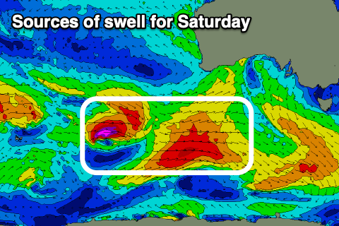
With this a further pulse of swell is due later Friday, peaking Saturday morning to 3ft+. There’ll actually be quite a mix of swells in the mix Saturday from the earlier incarnations of the system moving through Friday.
Winds should tend W/NW through the morning ahead of fresh S/SE sea breezes while Sunday should see morning N’ly winds ahead of a trough and shallow S’ly change. The surf should still be 2ft+ but on the ease.
Looking at early next week and a low forming off the coast to our north-east looks to bring tricky winds from the eastern quadrant along with a moderate sized S/SW groundswell. More on this Friday.

