No major surf until late next week
Southern Tasmanian Forecast by Craig Brokensha (issued Friday August 23rd)
Best Days: Sunday
Features of the Forecast (tl;dr)
- Easing W/SW swell tomorrow with rapidly deteriorating conditions as E/NE tending SE winds freshen
- Small SW swell Sun with N/NW tending fresher N/NE-NE winds
- Fading swell Mon
- New W/SW swell energy from late week
Recap
The surf bottomed out through yesterday but today, our new pulse of W/SW swell came in on forecast with 2ft+ sets under a fresh offshore wind. This afternoon is now bumpy with winds swinging onshore, something we haven’t seen for a while.
This weekend and next week (Aug 24 - 30)
This morning’s spike in swell is now on the ease, with the weekend due to see a continued dropping trend. Tomorrow morning may still be 1-2ft but winds look dicey, tending from a dawn E/NE’ly around to the SE very quickly before strengthening into the afternoon.

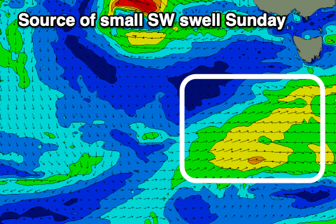
This makes tomorrow a most likely lay day with Sunday seeing a small new SW small with N/NW tending N/NE-NE winds.
The source will be a weak, trailing front passing under us today and should keep sets around 1ft to occasionally 2ft. This looks like the best day to target for a paddle.
We then look at tiny surf early to mid next week ahead of some more favourable swell producing systems later week and beyond.
This will be as the strong frontal activity that’s been impacting the Indian Ocean moving further east, across Australia. The question for the Southy Arm is how far north will it sit. ECMWF has the activity a bit more favourably aligned in our swell window, but more on this Monday. Have a great weekend!

