Fun S swell tomorrow
Southern Tasmanian Forecast by Craig Brokensha (issued Monday August 19th)
Best Days: Tomorrow morning, Wednesday morning, Friday morning, Saturday morning
Features of the Forecast (tl;dr)
- Small-mod sized S'ly swell tomorrow AM, easing into the PM, fading Wed
- Tiny S/SE swell Wed, fading Thu
- Moderate N-N/NE winds tomorrow AM, shifting NE into the PM and freshening
- N/NW tending W/NW winds Wed
- Small W swell Fri, fading on the weekend
- W/NW tending fresh W/SW winds Fri
- N/NW tending strong N/NE winds Sat/Sun
Recap
A poor weekend of surf with tiny, onshore waves Saturday and a building windswell through Sunday.
Today we’ve got cleaner conditions and fun levels of S/SE windswell to 2ft+, while some stronger mid-period S’ly swell is now showing with variable winds.
This week and weekend (Aug 20 - 25)
Later today’s and more so tomorrow’s mid-period S’ly swell was generated by a healthy polar frontal system directing a fetch of strong S/SW winds up on the edge of our swell window yesterday and today.
A peak to 2-3ft is due tomorrow, easing later and then 1-2ft on Wednesday morning.
Moderate N-N/NE winds will swing NE into tomorrow afternoon and freshen a little so surf in the morning, with N/NW tending W/NW winds on Wednesday.

Into Thursday, mostly tiny surf is due but some background S/SE groundswell may prevent Clifton from going flat.
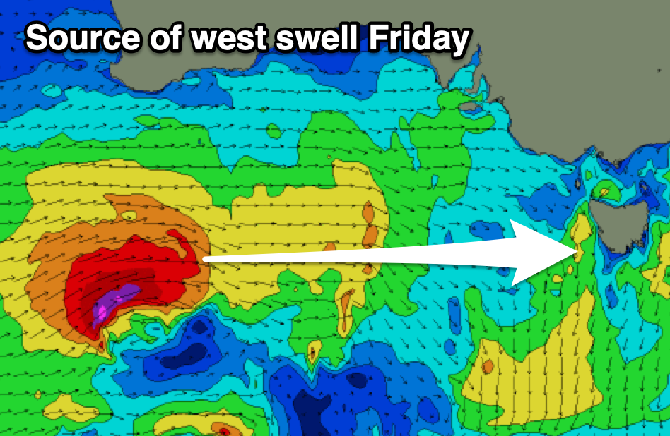
Our next increase in swell is due on Friday though, generated by a tricky mid-latitude low passing right on the edge of our western swell window.
Fetches of gales look to be right on the periphery with a small pulse to 2ft due Friday with W/NW tending W/SW winds.
The weekend will be cleaner but with what looks to be fading 1-1.5ft sets.
Looking longer term and there’s nothing significant at all due early-mid next week with some tricky W’ly swell likely late week again. More on this Wednesday.

