Make the most of the coming days
Southern Tasmanian Surf Forecast by Craig Brokensha (issued Friday July 5th)
Best Days: Today, tomorrow, Sunday, Monday
Features of the Forecast (tl;dr)
- Moderate sized SW groundswell later today, peaking tomorrow AM, easing
- W/NW-NW tending variable winds tomorrow
- Reinforcing SW swell Sun PM and Mon AM with N/NW tending E/NE winds Sun, N tending fresh NE Mon
Recap
Small 2ft waves persisted across Clifton yesterday and this morning with clean conditions under light winds. Some new SW groundswell is due later this afternoon pulsing to 2-3ft.
This weekend and next week (Jul 6 - 12)
This afternoon’s increase in SW groundswell is due to peak tomorrow morning to a strong 3ft+ across Clifton, generated by a great fetch of severe-gale W/NW winds moving through our swell window this week.
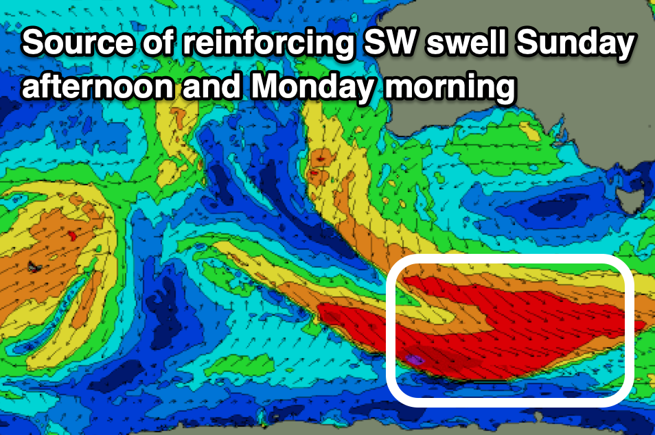
There might be a temporary low point in swell Sunday morning, while some new swell is due into the afternoon and Monday morning to 2-3ft, generated by a secondary frontal system generating a broad fetch of W/NW winds this evening and tomorrow.

Winds look great tomorrow and W/NW-NW tending variable with N/NW tending E/NE winds on Sunday and N tending fresher NE winds Monday as the swell eases.
Make the most of the coming days of swell as the surf will bottom out from Tuesday through the rest of next week, with the next pulse of energy due from the W next weekend.
This will be from a northward tracking frontal progression moving in from the west, not ideal at all. Check back here Monday for an update on the expected size across the state. Have a great weekend!

