There are no standout swells this period
Southern Tasmanian Surf Forecast by Craig Brokensha (issued Monday June 24th)
Best Days: Today, Wednesday afternoon and Thursday morning for beginners
Features of the Forecast (tl;dr)
- Inconsistent background SW swell for Wed PM, easing Thu with N/NW-N winds
Recap
A slow start to Saturday but our new pulse of SW groundswell for the afternoon kicked nicely, easing through yesterday from a fun 2ft+ with all day favourable conditions.
This morning is still 1-2ft but easing.

This morning's leftovers
This week and weekend (Jun 25 - 30)
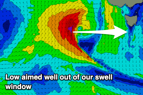
As touched on last week, the coming outlook is slow thanks to all the swell generating systems coming in from the west expected to sit too high of our swell window.

A low that’s currently south of the Bight is generating a fetch of gale to severe-gale S/SW winds that are aimed into South Australia, out of our swell window.
Otherwise, a tiny background increase in swell to 1-1.5ft may be seen Wednesday afternoon, fading Thursday under offshore N/NW-N winds.
The weekend looks to remain tiny with the next swell possibility coming from another mid-latitude low moving in slowly from the east next weekend and into early next week.
The models diverge on how this will evolve so check back here Wednesday and Friday for updates.


Comments
So has the daily report been taken over by gross as it's decidedly optimistic given what is on the water