Strong surf to continue
Southern Tasmanian Forecast by Craig Brokensha (issued Friday May 17th)
Best Days: This afternoon, tomorrow, Tuesday, Wednesday
Features of the Forecast (tl;dr)
- Low point in swell Fri AM, building again (moderate + in size) into the PM with strengthening SW winds
- Easing moderate sized swell tomorrow with fresh W/NW-NW winds
- Mod sized W/SW swell Sun with W/SW tending SW winds (possibly W/NW at dawn)
- Easing swell Mon with W/SW-SW winds (possibly W/NW at dawn)
- Moderate sized S/SW groundswell for Tue with NW tending W/NW winds, then W/SW later
- Easing swell Wed with W/NW winds
Recap
Our strong pulse of SW groundswell for yesterday morning came in on cue with clean conditions and 3-4ft waves across Clifton, easing back to 2-3ft today but with unfavourable winds and conditions.
This is thanks to the new swell generating front pushing through, with a solid kick in size to 4-5ft due by later today.

Building swell this arvo

This weekend and next week (Apr 18 - 24)
This afternoon’s strong increase in swell energy will start to ease through tomorrow, but the morning still looks to be around 4ft or so, backing off to 2-3ft into the afternoon.
Winds should quickly improve thanks to the next swell generating front moving in, swinging them around to the W/NW and even NW early afternoon.
Sunday looks dicey with the front passing, bringing a pre-dawn W/NW’ly that should shift W/SW around dawn and then stronger SW-S/SW into the afternoon.

Some new mid-period W/SW-SW swell is due from the frontal system, coming in at 3ft on the sets, easing back through Monday from 2ft+ but with lingering W/SW tending SW winds. It shouldn’t be too windy, so we may see local W/NW winds prevail early.
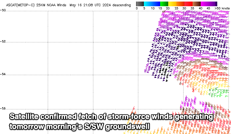
Into Tuesday, our new S/SW groundswell is expected, generated by a polar low forming south of us on the weekend. A slim fetch of severe-gale to storm-force winds should produce a kick back to 3-4ft under NW winds, tending W/NW into the afternoon ahead of a late W/SW change.
Following this the outlook remains active with some small mid-period swell energy due later week ahead of some possible stronger stuff again next weekend. More on this Monday. Have a great weekend!

