Strong swells developing through the week
Southern Tasmanian Surf Forecast by Craig Brokensha (issued Monday May 13th)
Best Days: Thursday, Saturday, Sunday morning
Features of the Forecast (tl;dr)
- Small, weak W/SW swell for tomorrow with early W/NW tending W/SW winds, bacl to the W later
- Tiny early Wed, with a building W/SW swell into the PM with N/NW winds
- Moderate sized SW groundswell Thu AM, easing with mod-fresh N/NW tending W/NW winds
- Reinforcing, moderate +sized W/SW swell for Fri PM with mod-fresh W/SW winds, strengthening
- Easing swell Fri Sat with N/NW winds
Recap
Friday's strong swell eased back from a good, clean 2-3ft on Saturday morning but it was mostly overpowering the beaches, better yesterday and a fun 1-2ft.
This morning the swell has bottomed out with tiny waves for beginners.
This week and weekend (May 14 - 19)
We've got an active week of surf on our cards after it temporarily bottomed out today.
A weak frontal system moving across us this evening and tomorrow should generate a weak, 1ft to occasionally 2ft of westerly swell for tomorrow across Clifton, easing back to 1-1.5ft Wednesday morning.
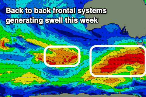
This drop will be temporary thanks to the arrival of a strong Southern Ocean frontal system during the day and subsequent increase in mid-period energy through the afternoon.
This front will generate a great fetch of pre-frontal, strong to gale-force W/NW winds, followed by similar strength, post-frontal W/SW winds.

The groundswell from this systems is due to peak early Thursday with 4ft sets due across Clifton, easing through the day under a N/NW tending W/NW breeze.
The easing trend will be short, with another strong pulse of W/SW swell is due into Friday afternoon, produced by a secondary strong frontal system moving in Thursday.
This looks to generate patchier fetches of gale to severe-gale W/SW winds and another spike to 4ft or so Friday afternoon, easing Saturday from 3-4ft or so thanks to a final front moving up past the state.
This front will bring average winds Friday, moderate to fresh from the W/SW, strengthening during the day, with N/NW winds on the cards for Saturday.
Sunday through early next week looks smaller but still fun with more swell on the cards for mid-late next week. Check back Wednesday for more details.

