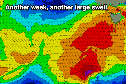
Tiny week before kicking in size late Friday
Southern Tasmania Surf Forecast by Craig Brokensha (issued Monday 9th August)
Best Days: Late Friday, Saturday protected spots, Sunday, Monday, Tuesday week, Wednesday week
Features of the Forecast (tl;dr)
- Tiny, fading surf tomorrow, flat Wed
- Tiny W swells Thu and Fri
- Strong W/SW groundswell building late Fri with N/NW tending W/NW winds, large from the SW Sat with strong W/NW tending W/SW winds
- Easing SW swell Sun with N/NW winds, shifting W/SW late
- Reinforcing SW groundswell for Tue
Recap
Clean early Saturday ahead of an onshore change and rain mid-morning, creating average conditions with a solid W/SW groundswell. Yesterday was much better with great conditions and solid 3-4ft surf, easing back rapidly to 2ft this morning, a bit quicker than anticipated.
This week and weekend (Aug 10 - 15)
Down, down, down.
The weekend's swell will continue to fade into tomorrow, leaving tiny surf across Clifton, near flat on Wednesday. Winds will be OK and strengthening from the N/NE tomorrow, shifting N/NW and becoming stronger on Wednesday.
Now, as touched on in Friday's notes, an infrequent W'ly groundswell showing on the charts for Thursday has been generated north of our swell window and isn't expected to get into the South Arm.
Instead, mid-period energy is more likely, generated from the remnants of the significant frontal progression linked to the swell pushing east towards us, generating strong W-W/NW winds.
 1ft of swell is likely Thursday with 1-1.5ft sets possibly Friday along with strong W/NW winds on the former, easing through the day and N/NW tending W/NW winds Friday.
Of greater importance is a front, come low firing up south-west of us late week, with an initial great fetch of gale to near severe-gale W/NW winds then spawning into similar strength W/SW winds right under us Friday.
This will see a moderate-large SW groundswell generated, with the size kicking late Friday from the W/SW ahead of a peak Saturday to 4-5ft or so but with strong W/NW tending W/SW winds. Offshore N/NW winds are then due again Sunday morning with the swell easing back from the 3-4ft range.
Longer term, continued polar frontal activity should produce a reinforcing SW groundswell early next week but more on this Wednesday.

