Easing S/SE groundswell, slow thereafter
Southern Tasmania Surf Forecast by Craig Brokensha (issued Wednesday 30th June)
Best Days: Tomorrow, Wednesday through Friday next week
Features of the Forecast (tl;dr)
- Easing S/SE groundswell tomorrow with fresh N'ly winds
- Small SW swell for Tue with S winds
- Better S/SW swell for Wed with N tending variable winds
Recap
Monday's swell dropped back overnight, easing from a clean, fun 2ft yesterday, while today a new S/SE groundswell has filled in, with some spots seeing more size than others.
This week and next (July 1 - 9)
Today's S/SE groundswell is peaking now and we'll see it easing in size through tomorrow, fading from an inconsistent 2ft across Clifton. More exposed locations down the arm, open to the swell direction should be bigger.
Conditions will be clean all day with a fresh N'ly. Make the most of it as there's no decent swell on the cards until next week following this.
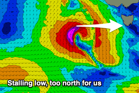
 The weekend will be tiny as a mid-latitude forming to our west sits too far north to generate any size for the South Arm.
We then rely on a weak polar frontal system firing up along the polar shelf to generate small pulse of swell next week. The first pulse of swell (for Tuesday) to 1-2ft is due to be generated by a broad fetch of strong W/NW winds, south-southwest of Western Australia.
A slightly stronger frontal system forming south-southwest of us late in the weekend and Monday will hopefully produce a bit more size to 2ft or so on Wednesday, with a possible third pulse for late week.
Conditions for each swell look favourable with persistent winds out of the north (excluding Tuesday). Longer term there's still nothing major on the charts, but we'll continue to keep an eye on things.

