Fun swells from Friday
Southern Tasmania Surf Forecast by Craig Brokensha (issued Wednesday 23rd June)
Best days: Tomorrow for the keen, Friday morning, Saturday, Monday, Tuesday morning
Features of the Forecast (tl;dr)
- Small S/SW swell for tomorrow with N tending variable winds
- Good SW groundswell for Fri with variable tending S/SW winds
- Reinforcing SW swell Sat with W/NW tending NW
- Stronger SW groundswell building Sun with strong SW winds, easing out of the S/SW Mon with N/NW tending NE winds
Recap
Fading surf and only suitable for beginners.
This week and next (Jun 24 – July 2)
Into tomorrow a small new pulse of S/SW groundswell may be seen, with a much stronger and better pulse for Friday.
Tomorrow's was generated by a late forming polar fetch of W'ly gales in our swell window and may produce a 1-2ft wave, with Friday's generated by a stronger severe-gale fetch of W/NW tending W winds moving along the polar shelf.
This strongest pulse should see sets to 3ft across Clifton, easing into the late afternoon.
Local winds will be best tomorrow and N most of the day, variable into the afternoon with Friday now likely to see early, light variable winds, tending S/SW through the day as a trough moving in from the west is delayed slightly. There's a chance for moderate S winds at dawn, but hopefully local effects kill this off.
A stronger onshore change is likely overnight Friday, reverting back to the W/NW on Saturday morning and NW into the afternoon.
This will be with a reinforcing pulse of mid-period SW swell, generated by pre and post-frontal fetch of strong to gale-force W/NW - W/SW winds pushing through our swell window tomorrow.
2ft+ sets are due all day and with that favourable wind.
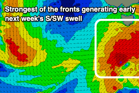
Now, moving into Sunday and our larger swell from the strongest and most favourably aligned polar storms is due to build.
 This polar storm will see an initial fetch of W'ly gales south of WA, ridden over the top by a slightly stronger fetch of W/SW gales, projecting north-east towards us.
The front will move through early Sunday bringing a strong SW change (possibly reverting to the W for a period in the morning) but mostly onshore with building surf to 4ft+ due into Sunday afternoon.
The swell is due to peak overnight and ease steadily Monday from 3-4ft out SW-S/SW along with NW tending NE winds.
Following this there's nothing too significant on the cards so make the most of the coming swell.

