Large swell for the weekend
Southern Tasmania Surf Forecast by Craig Brokensha (issued Friday 9th April)
Best Days: Selected locations tomorrow, possibly early Friday, Saturday
Features of the Forecast (tl;dr)
- New SW swell Sat with strengthening N/NW tending W/NW winds
- Large W/SW-SW-S/SW groundswell filling in Sun (kicking late Sat) with strong W/SW tending SW winds, easing Mon from the S/SW with strong SW winds at dawn, abating and easing
Recap
Tiny, clean 1-1.5ft waves yesterday, back to 1ft today and ideal for beginners.
This weekend and next week (Apr 10 - 16)
Tomorrow should see a small lift in swell from a relatively weak but favourable polar front mid-week, offering 2ft sets across Clifton. Winds will strengthen from the W/NW through the day, light out of the N/NW early as the 'bombing' low starts to edge in.
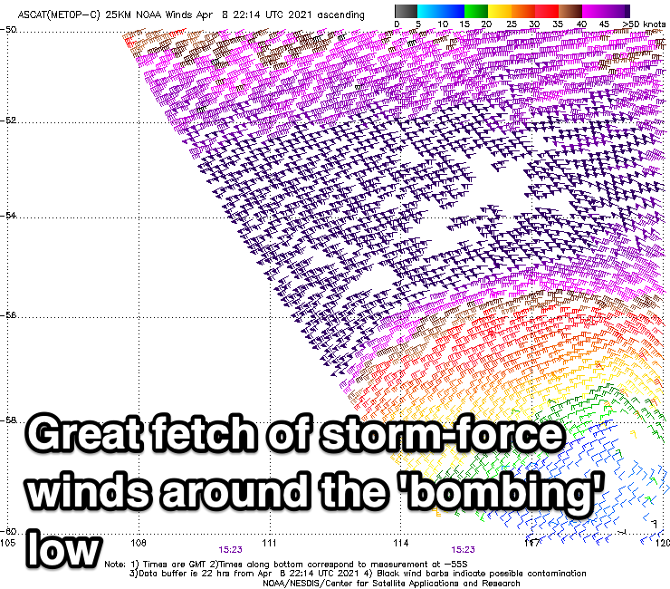
We then look at the large, long-period W/SW tending SW groundswell from the 'bombing' low that's currently slowly weakening while projecting north-east towards us today.
Satellite observations confirm a great fetch of storm-force W/SW winds in our western swell window and this will continue today, weakening very slightly over the coming 24 hours as it projects right up and into Tasmania and our state tomorrow evening.

The final stages of the low when it pushes up and into us Sunday will bring an additional S/SW component to the swell.
Size wise we'll likely see a late increase in size tomorrow to 2-3ft, with Sunday still coming in around the solid and consistent 6ft range. Winds will be strong from the W/SW, shifting SW through the day.
Winds look to remain strong at dawn Monday from the SW, but abating quickly and tending light into the afternoon as the swell eases out of the S/SW from the 3-5ft range. Tuesday looks to be back to 2ft and nice and clean.
Longer term there's nothing too major on the cards but more on this Monday. Have a great weekend!

