Fun surf over the coming days, large into the weekend
Southern Tasmania Surf Forecast by Craig Brokensha (issued Monday 5th April)
Best Days: Tomorrow morning, Wednesday, Thursday, Sunday and Monday protected spots
Features of the Forecast (tl;dr)
- Easing surf over the coming days with morning offshore winds
- Large W/SW-SW groundswell filling in Sun with strong W/SW winds, easing Mon with similar winds
Recap
Tiny surf Saturday, with a building swell through yesterday from a clean 2ft in the morning. Today there's more size again but conditions weren't as clean with a light morning W'ly which has since gone variable.
This week and weekend (Apr 6 - 11)
The strong, zonal frontal progression linked to yesterday's and today's swell has since moved off to the east and the energy is peaking across the South Arm this afternoon.
We'll see the size slowly tail off over the coming days, but continued activity south-west of us today and tomorrow will slow this trend until Thursday. We're still seeing a great, broad fetch of W/NW gales being generated and this will produce some reinforcing groundswell Tuesday and Wednesday.
Size wise, Clifton should ease from 2-3ft tomorrow morning, holding 2ft on Wednesday and then ease from 1-2ft on Thursday.
Sea breezes are looking a little stronger into the afternoon tomorrow with a light NW offshore, fresher S/SE into the afternoon, NW tending E/NE on Wednesday with N/NW tending variable winds Thursday.
Moving into Friday and a weak front will push through, bringing a W/SW change but no real significant swell above 1-2ft in its wake.
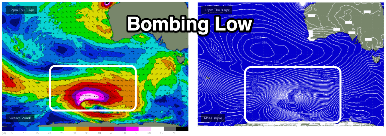
Of greater interest is a significant, 'bombing' low on the cards later this week, forming east of the Heard Island region. A 'bombing' low is one that drops 24hPa or more within 24 hours and this will drop about 34hPa from Wednesday afternoon to Thursday afternoon.
This will see a fetch of storm-hurricane force W'ly winds firing up along the polar shelf, projecting east and then north-east, up and across us Saturday afternoon and into Sunday.

A large, long-period and consistent W/SW-SW groundswell is due from this source, filling in Sunday and peaking through the day. Size wise we'll be looking at surf to 4-6ft across Clifton (the models are incorrectly combining swells and also showing a more south direction - over forecasting the size), easing Monday from 4-5ft. Winds will be strong from the W/SW favouring protected spots both Sunday and Monday, cleaner Tuesday.
Check back here over the coming updates for an idea on how this swell and low is tracking.

