Significant swells inbound this period
Southern Tasmania Surf Forecast by Craig Brokensha (issued Monday 29th July)
Best Days: Tomorrow AM protected spots, Wednesday, Friday, Saturday and Sunday
Recap
Small clean waves to 2ft most of the weekend with a mix of swells, bigger than expected on Saturday.
Today onshore winds have moved in along with 2ft of swell, and a strong new S/SW groundswell should have built late across the coast.
Today’s Forecaster Notes are brought to you by Rip Curl
This week and weekend (Jul 30 – Aug 4)
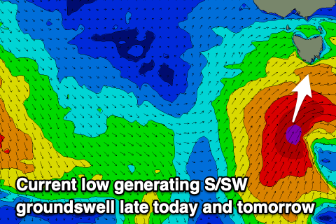
Last night and today, a strong low forming south-southwest of us has been aiming a fetch of S/SW gales in our southern swell window, generating a moderate sized S/SW groundswell that should of shown across the coast later today.
 A peak is due overnight, but the slow moving nature of the low will see solid sets holding into tomorrow morning and good sized waves Wednesday.
We're expecting 4-5ft waves tomorrow morning, easing slowly through the day and then backing off from the 3ft range Wednesday.
Winds tomorrow will remain onshore and out of the W/SW, favouring protected spots, N/NW tending variable on Wednesday.
Moving into the end of the week we'll start to see increased activity to our south-west as a strengthening node of the Long Wave Trough moves across New Zealand, steering and strengthening polar storms up and under us.
The first will be a very strong pre-frontal fetch of severe-gale W/NW winds, followed by a weaker post-frontal W/sW fetch, resulting in a building swell Thursday afternoon likely to 3ft by late, but with a strong W/SW change. Friday morning should reveal a touch more size to 3ft to possibly 4ft, though easing steadily with N/NW tending W/NW winds.
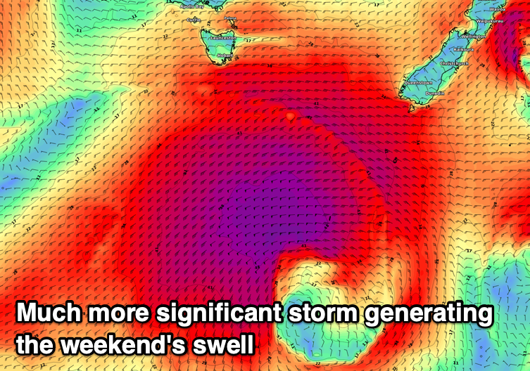
 Of greater significance is a much stronger polar storm due to develop south-west of us on Friday.
A broad and encompassing fetch of severe-gale to storm-force SW winds are forecast to be generated in our southern swell window, moving slowly and projecting towards New Zealand over the weekend.
A large and powerful long-period S/SW groundswell is expected, building Saturday afternoon and reaching 6ft+ by dark. A slow drop in size is then expected Sunday from 4-6ft. Winds look onshore from the W/SW on Saturday and NW Sunday, opening up plenty of options for experienced surfers.
We'll have another look at this swell in the coming two forecast updates though.


Comments
Awesome..... It's been only 8 long years between these type swells for us!