Small SW swell tomorrow, S/SE groundswell Sunday
Southern Tasmania Surf Forecast by Craig Brokensha (issued Friday 6th April)
Best Days: Saturday, Sunday, maybe dawn Monday
Recap
Fun easing surf from 2ft+ yesterday morning, back to 1-2ft this morning with nice clean conditions.
Today’s Forecaster Notes are brought to you by Rip Curl
This week and weekend (Apr 7 - 13)
Small sets to 2ft should persist across Clifton tomorrow, generated by a relatively weak but slow moving polar front through our swell window the last couple of days. The front is weakening south of us, and with this we'll see the swell fade from 1ft to maybe 2ft Sunday.
 Conditions will be clean tomorrow morning with a NW offshore, tending W/NW into the afternoon, while a light NW breeze is due Sunday morning, increasing from the N/NE into the afternoon.
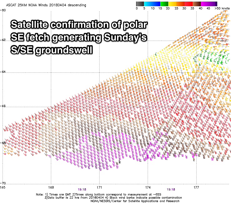
Our new S/SE groundswell for Sunday is on track with satellite observations picking up a great fetch of gale to severe-gale SE winds south of New Zealand, in our south-eastern swell window.
This should have produced a good S/SE groundswell for later tomorrow, peaking Sunday to a good 2ft across Clifton (bigger at more exposed breaks), easing from 1-2ft Monday.
Unfortunately winds on Monday look dicey as a surface trough moving in from the west brings a W/SW change shortly after dawn, swinging SE through the day.
A very tiny and weak S/SE windswell may be seen Tuesday in the wake of this trough under a gusty N'ly wind, swinging W/NW late in the day.
Unfortunately for the rest of the week there's nothing too major on the cards, as strong polar frontal activity projecting towards WA and then under the country sits too north to generate any major swell.
A small 1-2ft of W/SW groundswell may be seen Thursday, but we'll have another look at this Monday. Have a great weekend!

