Easing surf tomorrow ahead of a good SW groundswell Friday
Southern Tasmania Surf Forecast by Craig Brokensha (issued Wednesday 21st March)
Best Days: Thursday morning, Friday, early Saturday, early Tuesday
Recap
Large windy surf only suitable for protected spots yesterday. Today the swell has halved but was still solid though with less than ideal winds from the eastern quadrant.
Today’s Forecaster Notes are brought to you by Rip Curl
This week and weekend (Mar 22 - 25)
Tomorrow will be smaller again but we should still see 2ft+ waves across Clifton in the morning with a better early N'ly wind, freshening from the NE through the morning.
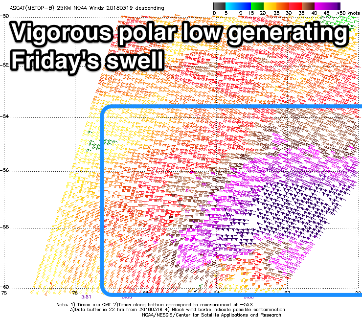
A low point in swell is due dawn Friday but our new SW groundswell is on track.
 Satellite observations confirmed a fetch fetch of severe-gale to storm-force W/NW winds in our medium-range swell window the last couple of days.
This swell should arrive through the morning and peak at an inconsistent 2ft to occasionally 3ft across Clifton with a N/NW tending fresh N/NE wind.
We'll see this swell fade through Saturday from a small 1-2ft max under offshore N/NW winds.
Into early next week we'll see an intense mid-latitude low push east and across us, with a fetch of westerly winds not falling in our swell window, though a trailing fetch of strong S/SW winds pushing into us Monday should kick up a late increase in windswell, peaking Tuesday morning.
We're looking at 2-3ft surf with a possible early W/NW breeze, but we'll review this Friday. Beyond this there's plenty activity due late week owing to a strong new node of the Long Wave Trough moving in from the west, but more on this Friday.

