Small clean waves, biggest and best Sunday morning
Southern Tasmania Forecast (issued Wednesday 3rd September)
Best Days: Friday morning, Saturday, Sunday
Recap
Tiny waves have continued across the coast yesterday and today and the trend continued.
This week and weekend (Sep 4 - 7)
Tomorrow is expected to start out tiny again, but a new long-range W/SW groundswell is due into the afternoon, reaching 1-2ft axross Clifton but winds will be onshore form the W/SW.
The swell should hold into early Friday to 1-2ft before fading through the day under morning NW winds.
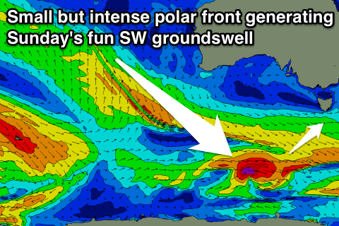
 The weekend is looking a little better now as a strong but short-lived polar front fires up along the polar shelf this evening, weakening tomorrow followed by a secondary system Friday.
This should produce two pulses of SW groundswell, the first arriving Saturday, coming in at an inconsistent 2ft on the sets, with a secondary pulse Sunday morning to 2ft.
Winds will be favourable and from the NW all day Saturday with N/NW tending N/NE winds Sunday (this will be the pick of the weekend).
Next week onwards (Sep 8 onwards)
The swell will ease into the start of next week and bottom out Tuesday and Wednesday. As touched on last update though, a strong node of the Long Wave Trough is due to move in later next week and this should provide us with some larger W/SW groundswell activity. More on this Friday.

