Limited windows for the South Coast with a fun west swell later week
South Australian forecast by Craig Brokensha (issued Monday March 31st)
Best Days: South Coast Wednesday morning, Mid Coast Friday, both coasts next Tuesday
Features of the Forecast (tl;dr)
- Moderate + sized S/SW groundswell for tomorrow with E-E/NE tending S/SE winds
- Easing swell Wed with variable tending S/SW winds (freshening)
- Smaller Thu with early variable tending gusty S winds
- Moderate sized W/SW swell Fri with S/SE tending S/SW winds
- Smaller reinforcing SW swell Sat with S/SE tending S/SW winds
- Larger SW-S/SW swells for early next week with SW winds Mon, variable E-E/NE Tue AM
Recap
There was no surf of note over the weekend with poor, onshore and stormy surf across the South Coast, tiny to flat inside the gulf.
Conditions are still a stormy mess across the South Coast this morning with nothing of note inside the gulf.
This week and weekend (Apr 1 - 6)
As touched on last week, we’ve got a good groundswell due into later today but more so tomorrow, generated by a strong, elongated frontal progression swinging in from the Indian Ocean, generating fetches of gale to severe-gale W-W/NW winds on the polar shelf.
While kicking later today, the strongest pulse is due into tomorrow with 3-5ft sets due across Middleton, though mixed in with some poor quality S/SE windswell. The Mid Coast isn’t expected to top 0.5-1ft owing to the southerly nature of the swell being blocked by Kangaroo Island.
Winds are due to ease and shift more E-E/NE across the South Coast but it will be very lumpy and disorganised, so lower your expectations.

Wednesday might be a better option for a surf as the S/SW groundswell backs off from 4ft (on the sets) across Middleton under variable offshore winds.
A trough will bring a shallow S/SW change later in the morning so surf before then.
Thursday is tricky, and not worth worrying about too much as a trough brings a gusty S’ly change through the morning, with an outside chance of early variable winds but smaller surf.
The trough will actually spawn off a strong polar low that’s currently south-west of Western Australia, projecting north through today. A fetch of W/SW-SW gales will be generated through our western swell window, generating a moderate sized mid-period W/SW swell for Friday, coming in at 2ft across the Mid Coast with 3ft to occasionally 4ft sets developing across Middleton.
S/SE tending S/SW winds will favour the Mid Coast on Friday, with similar winds on Saturday as the swell backs off from 1-1.5ft with 3ft sets hanging in off Middleton as a reinforcing mid-period SW swell fills in.
This will be produced by a distant but strong polar storm on the backside of the low projecting towards Western Australia.

Into Sunday but more so early next week, a much more significant and exciting run of large Southern Ocean swell is expected.
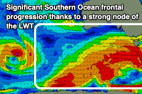
This will form as a strong node of the Long Wave Trough forms over the south-east of the country, firing up a strong Southern Ocean frontal progression, with multiple significant polar storms due to project up and into us from Friday evening through the weekend.
This looks to generate a large run of SW-S/SW groundswell into early next week with SW winds Monday swinging back E/NE on Tuesday. More on this Wednesday and Friday.


Comments
Hey Craig, any update on this alge bloom. Will these new stronger winds and rise in swells fix it?
Yeah they should, will mix up the ocean and put an end to it thankfully.