Surf today and through the weekend
South Australian Surf Forecast by Craig Brokensha (issued Friday December 9th)
Best Days: Today South Coast until mid-late afternoon, afternoon Mid Coast for novelty waves, South Coast tomorrow morning, South Coast early Sunday
Features of the Forecast (tl;dr)
- Small background SW swell Sat/Sun with fresh NE winds Sat AM, tending E/NE late AM and E'ly mid-PM
- Early W/NW winds Sun, tending SW and freshening mid-late AM
- Weak SW windswell Mon, easing Tue with strong SW winds Mon, W tending SW winds Tue
- Moderate-large sized S/SW swell Wed with strong S/SW winds (possibly S/SE late on the Mid)
- Easing swell Thu with mod-fresh S/SE winds
Recap
Poor surf continued across the South Coast yesterday thanks to a strong onshore wind. There was a bit of size linked to new SW groundswell, and the Mid Coast was full and tiny through the morning before pulsing to 1-2ft with the afternoon, incoming tide.
This morning the swell is still 3ft across Middleton and peaky (improving) with a cross-offshore wind while the Mid has dropped back to a tiny 0.5-1ft. Winds should hold out of the E/NE until mid-afternoon at least, so it's worth a surf before winds go E/SE into the late afternoon.

Good kick in size with the tide yesterday PM

Head-high peaks this AM
This weekend and next week (Dec 10 - 16)
On the weekend we'll see the heat start to build as an approaching trough swings winds more NE tomorrow morning (moderate to fresh in strength), tending E/NE late morning and E'ly into the mid afternoon. A late N/NW change now doesn't look to be on the cards unfortunately due to the trough being weaker and slower moving in from the west.

Size wise, today's energy will ease further and there should still be fun 2ft sets across Middleton, a little bigger on the swell magnets.
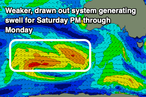
A small, reinforcing mid-period SW swell is due into the afternoon, keeping the surf a similar size all day. This was generated earlier in the week by a broad but relatively weak low to the south-west of Western Australia.
There'll be a secondary reinforcing pulse of swell for Sunday and due to the slower/weaker nature of the trough arriving from the west, we've got a window of light W/NW winds in the morning ahead of a gusty SW change mid-late morning. So hit the magnets early.
Next week unfortunately looks to be a total write-off thanks to persistent onshore winds and no major strength to the troughs that will bring the cooler weather and wind early-mid week.
We were expected to see a strong low form on Sunday/Monday but with this now being a weaker trough, there'll be no significant size generated for the Mid or South Coast. Strong SW winds will create poor conditions along with weak windswelly waves. The Mid looks to reach 1-2ft with 3ft surf down South, easing from a similar size Tuesday morning. There might be a brief period of W'ly winds early Tuesday, but with the weak nature of the swell, it won't be worth chasing too hard.

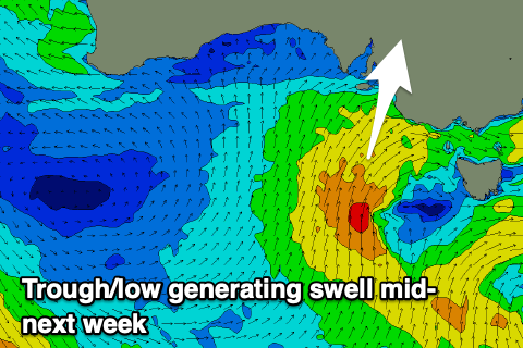
A secondary trough/low projecting towards us Tuesday should bring a moderate-large sized increase in mid-period S/SW swell on Wednesday, with 4-6ft sets due across Middleton. The Mid Coast will likely see 1-2ft sets on the favourable parts of the tide, but winds will remain an issue and strong from the S/SW. The Mid will likely see winds go S/SE on dark, creating improving conditions.
Easing surf with S/SE winds is expected on Thursday (tiny across the Mid Coast which will be cleanest) and then possibly E'ly winds Friday.
This all depends on the trough linked to Wednesday's swell, movement and developments in the Tasman Sea later week. If it stalls and deepens we'll see persistent SE winds across our region. Regardless swell sources look limited, but check back here on Monday for more on this. Have a great weekend!

