Fading surf on the Mid, improving down South from the weekend
South Australian Surf Forecast by Craig Brokensha (issued Wednesday September 28th)
Best Days: Mid Coast today, and for beginners tomorrow and Friday morning, South Coast Saturday, Sunday, Monday and Tuesday mornings
Features of the Forecast (tl;dr)
- Small-mod sized mid-period SW swell building Thu PM with moderate S/SE-SE winds, freshening
- Easing mid-period SW swell Fri with moderate SE tending fresh S/SE winds (possibly tending E/SE at periods in the AM down South)
- Easing surf Sat variable NE tending SE winds
- Late increase in SW groundswell Sat, peaking Sun with light-moderate NE tending fresh S/SE winds
- Easing surf Mon and Tue with fresh NE tending E/NE winds
Recap
Terrible conditions across both coasts yesterday morning with a strong onshore wind and mix of new swells. The Mid Coast improved into the afternoon as winds shifted a little more south.
Today the Mid is a little cleaner again with sets to 2ft for the keen. The South Coast is still a mess with gusty S'ly winds.

Good sets this AM in the gulf
This week and next (Sep 29 – Oct 7)
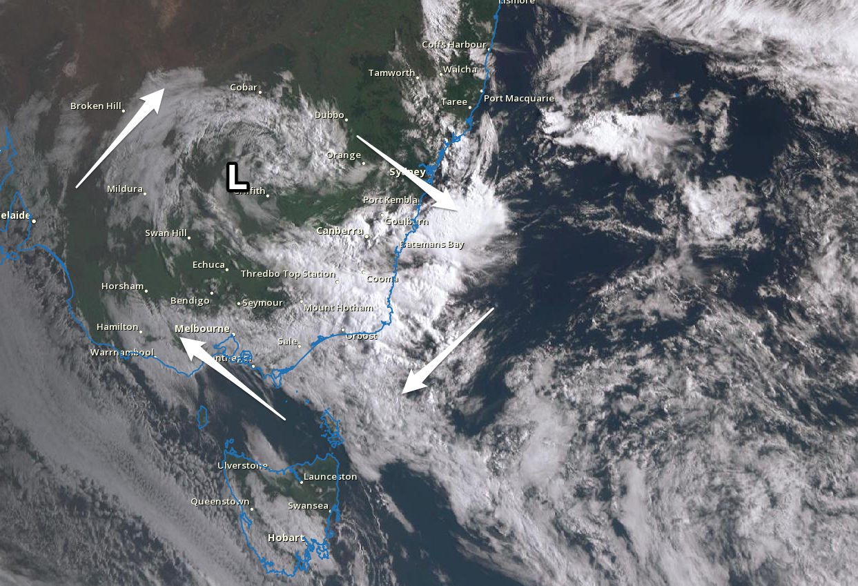
 The trough linked to our onshore change Monday has formed into a broad inland low which is currently sitting near Griffith. A high moving in from the west is squeezing its south-western flank, bringing the current run of gusty S'ly winds.
As the low moves further east and deepens in the Tasman Sea we'll see winds slowly clock around to the south-east and then east, best into the weekend and early next week as the high continues east, shifting winds more north-east.
Looking at tomorrow though, we'll see moderate S/SE-SE winds across the South Coast with a background swell to 2-3ft, clean on the Mid but with a drop in swell back to 1ft+.
A new pulse of mid-period SW swell is expected into the afternoon (generated at the start of the week), holding Friday morning as winds hold out of the SE across the Mid Coast and possibly tend E/SE at times down South. Size wise, the Mid will remain tiny and to 1ft+, while the South Coast looks to be in the 3ft range across Middleton and Goolwa. Those who are fit and keen should find a workable wave out east.
Moving into the weekend, we've got much cleaner and better surf expected down South, with winds tending variable and likely light NE Saturday ahead of sea breezes developing later morning.
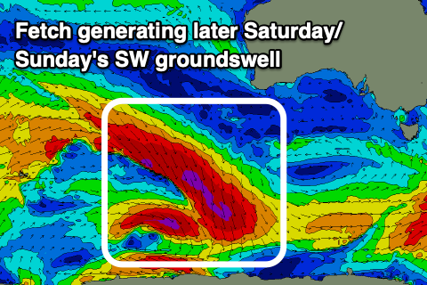
 We'll fall in between swell pulses Saturday morning with sets to 2ft across Middleton, better on the swell magnets. Into the afternoon and more so Sunday, a good new SW groundswell is still on track to fill in.
This is being generated by a funky, off-axis but significant fetch of severe-gale NW winds tracking south-east towards the polar shelf.
While not ideally aimed, the longevity and length of the fetch as well as its strength should help produce some decent sized sets on Sunday when it peaks as it spreads radially up towards us. Middleton should offer inconsistent but good 3ft sets, easing into Sunday afternoon and winds look light out of the NE through the morning ahead of sea breezes. This swell won't impact the Mid Coast with near flat surf expected on the weekend.
Another approaching mid-latitude low will bring fresher NE winds into Monday and Tuesday along with a drop in size from Sunday. Longer term it looks as if the mid-latitude low will bring onshore SW winds and a localised increase in SW swell later week, but we'll have a closer look at this Friday.


Comments
Hey mate, any chance you can ask the owners to clean the window or cam at Knights, was hoping it would clear by itself but seems it’s not budging
Yep, no worries, we'll sort it out.