Mixed outlook and best over the coming 24 hours
South Australian Surf Forecast by Craig Brokensha (issued Friday December 3rd)
Best Days: Today on the Mid Coast, tomorrow morning on the Mid Coast, Sunday for beginners on the Mid Coast, Monday morning South Coast
Features of the Forecast (tl;dr)
- Moderate sized+ W/SW groundswell peaking this afternoon with winds tending S/SE on dark
- Easing swell tomorrow with SE tending SW winds on the Mid, back to the S/SE late. Moderate S winds down South
- Easing surf Sun with light-mod SE winds, fresh S/SE into the PM
- Smaller, easing surf Mon with variable morning winds ahead of a freshening S'ly late morning
- S'ly winds for the rest of the week on the South Coast Tue-Fri
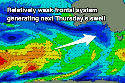
- New, mid-period SW swell Thu
Recap
Winds have been light and conditions better than expected across the South Coast both yesterday morning and this morning with a small 1-2ft swell yesterday and better, building swell this morning from 2-3ft across Middleton. The swell has since muscled up further and Cape du Couedic is looking very promising with sets due to hit 4-5ft this afternoon across Middleton but with an onshore breeze.
The Mid Coast was tiny yesterday morning but built into the afternoon with a gusty sea breeze, much better today with the stronger pulse of W/SW groundswell filling in. At dawn the surf was tiny but it quickly kicked to 2ft on the sets with the dropping tide and we should see 2-3ft sets this afternoon with the incoming push but with sea breezes. Expect winds to go back to the S/SE late though.


Glassy waves as the swell kicked and the tide dropped this morning
This weekend and next week (Dec 4 – 10)
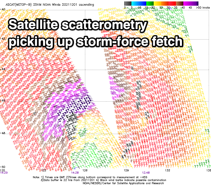
Our mix of long-range and closer-range, W/SW groundswell have filled in today and the Cape du Couedic wave buoy has rocketed up in size. Satellite observations of the low linked to today's best swell picked up some storm-force winds, helping to kick the size through today.

We should see Middleton reaching 4-5ft with 2-3ft sets on the Mid Coast but conditions are now deteriorating as a gusty SW'ly develops through the gulf. Winds will remain average until late when they'll shift back to the S/SE.
The swell will ease through tomorrow but we should still see 2ft sets in the morning on the Mid Coast swell magnets, though full and slow with the early high tide. The South Coast should still be around 4ft+, though easing and winds will favour the Mid with an early SE breeze, shifting SW mid-late morning and then shifting back S/SE late again. The South Coast will be sub-par all day with a moderate S'ly. In saying this the strength and size of the swell should still provide some fun options on the coast.
Winds will shift more SE on Sunday but the South Coast will remain average as the swell continues to ease. There is a chance for a lighter E/SE breeze but it'll be only for the keen. The Mid will be clean and crisp but tiny and only suitable for beginners once the early high tide recedes.
Monday is the pick of the period for the South Coast with winds due to go variable and likely light offshore. The surf will be smaller and easing from 2ft across Middleton, so try the magnets for a bit more push and size.
 Sea breezes look to kick in about the same time as a new trough pushes across us (late morning), bringing a strengthening S/SW wind into the afternoon. Unfortunately the trough is forecast to develop into a low off the southern NSW coast, stalling into the end of the week which will prevent a high to our west moving in. This will bring persistent and gusty S'ly winds for the rest of the week, tending more SE into next weekend.
Some new mid-period SW swell is due to fill in later Wednesday and peak Thursday but the source will be a polar frontal progression, a bit too south of the Mid Coast's swell window. Tiny 1ft+ waves should keep beginners happy while the South Coast looks to offer 3ft+ waves but with those poor winds. Therefore make the most of today and tomorrow in the gulf and the South Coast Monday morning. Have a great weekend!

