Run of poor surf on the way
South Australian Surf Forecast by Craig Brokensha (issued Wednesday November 17th)
Best Days: Today down South, possibly Saturday afternoon down South (check back Friday for one last look)
Features of the Forecast (tl;dr)
- Fading surf with strong N/NW tending W/NW winds tomorrow
- S/SE winds and small, weak surf Fri
- Building S/SW swell Sat but with fresh SE tending stronger S/SE winds (check back Fri for conformation)
- Junky S/SE windswell Sun with strong S/SE winds, easing Mon with S winds
- S winds and small surf next week
Recap
Reinforcing levels of mid-period S’ly swell kept the South Coast chunky through yesterday with 4ft+ sets and light, variable winds creating decent conditions for the keen and experienced through the morning. The Mid Coast was clean but tiny, best for beginners.
Today the swell has eased further but sets were still 3ft off Middleton and conditions cleaner. The Mid is clean but tiny to flat.
This week and next (Nov 18 - 26)
Make the most of today as we’ll see the surf easing further through the afternoon, bottoming out tomorrow under strong, tricky N/NW winds (shifting W/NW into the afternoon). Middleton might be 1-2ft but fading so try the swell magnets, though they won’t be great with that wind.
The Mid Coast will see a tiny windswell developing but to no considerable size.
The shift in winds will be ahead of a trough, bringing a S/SE change into Friday but with no new swell (a lay day).
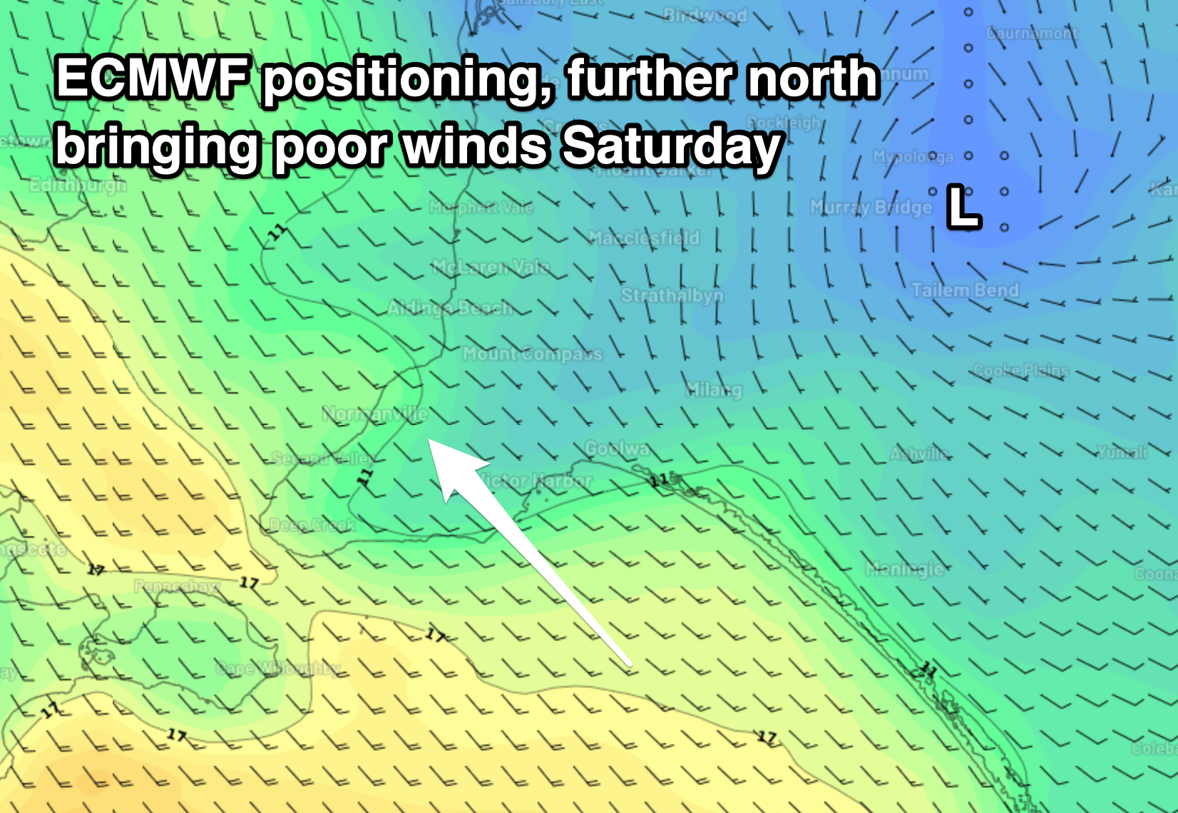
On Saturday we’ve got our dynamic day of wind and weather as an inland low drifts south-east across us but unfortunately it looks like we’re now set to see onshore winds from the get go, with no period of offshore breezes.
The models are still slightly divergent in regards to the movement of the low and the local winds but it looks like fresh E/SE tending stronger S/SE winds are now on the cards. This is due to the lows centre tracking a little further north than ideal, whereas if it were south we’d see winds swing more N’ly ahead of the southerly change.


We’ll have one final look at this Friday so check back then for any improvement to the expected conditions.
These winds will spoil a fun new mid-period S/SW swell that will fill in through the day. The source of the swell is a relatively weak but broad polar front projecting up towards Tasmania over the coming days.
Middleton should build to 3ft into the afternoon from this source, but there’ll also be some local S/SE windswell in the mix. The Mid won’t see any size owing to the southerly swell direction but should be clean.
Come Sunday stronger S/SE winds will persist, easing later along with moderate levels of junky windswell to 3-4ft or so.
Unfortunately the low will be replaced by another trough and high moving in from the west, bringing persistent winds out of the southern quadrant next week, classic November surf.
There’ll also be no new quality swell for either coast, leading to a run of poor surf. Get those chores done.
Longer term a stronger polar frontal progression may develop mid-late next week, south-west of Western Australia, bringing some new swell for next weekend. Winds also may improve from Sunday but we’ll have a closer look at this and one more look at Saturday’s tricky winds on Friday.


Comments
Welcome to spring/summer in SA, urrrrgh!
Someone build a wave pool for f…s sake…..
can you believe the knobheads ran a qs contest on ki a number of years ago in november obviously they didn't get any advice from someone in the know, was a total dud, Kolohe Andino was just a kid totally bagged the place