Large surf to end the week but onshore, much better weekend
South Australian Forecast by Craig Brokensha (issued Wednesday 3rd October)
Best Days: Saturday and Sunday mornings South Coast
Recap
Great waves across the South Coast yesterday once the offshore kicked in and ironed out some morning lump with good sized sets easing off Middleton.
This morning conditions were OK with Middleton hanging in at 3ft with a weak onshore breeze, but this has since strengthened, creating poor conditions. The Mid Coast has been tiny but good for beginners on the favourable parts of the tide.
Today’s Forecaster Notes are brought to you by Rip Curl
This week and weekend (Oct 4 – 7)
Our large and powerful long-period SW groundswell for tomorrow is still on track, but so are the poor onshore winds.
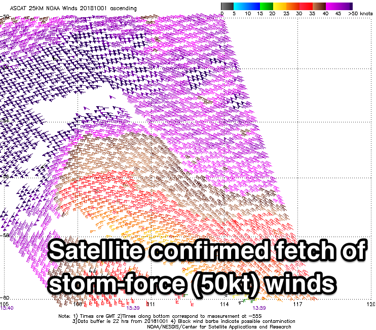
Satellite observations have confirmed a very impressive pre-frontal fetch of severe-gale W/NW winds and post-frontal storm-force W/SW winds in our south-western swell window yesterday and today.

The groundswell should arrive overnight and peak tomorrow to 6-8ft across the Middleton stretch and deepwater reefs, while the Mid Coast is only likely to see tiny 1ft+ surf.
The surface trough moving in today, bringing the onshore winds will see fresh and gusty S/SE winds persisting tomorrow, creating poor conditions down South.
Friday isn't looking too much better with winds due to swing more SE, possibly even E/SE but this won't improve conditions much at all.
 The groundswell will start easing from a more S/SW direction, likely from 4-5ft+ off Middleton and a tiny 1ft on the Mid Coast.
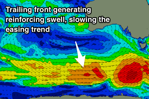
Much better conditions are due over the weekend as the S/SW swell continues to ease, slowed by a reinforcing pulse Saturday morning, generated by a trailing fetch of W'ly gales on the tail of the low linked to tomorrow's swell.
A deepening trough come mid-latitude low to our west should swing winds offshore from the NE-N/NE Saturday morning with easing sets from 3ft to occasionally 4ft off Middleton, tiny on the Mid Coast.
Sunday looks smaller and more to 2-3ft with good N/NE offshore winds, tending NW ahead of an onshore change as the low moves east across us.
Unfortunately onshore winds will then persist through Monday and Tuesday next week, improving mid-late week but with no decent swells on the cards owing to a large blocking high. More on this Friday.


Comments
Cape du Couedic solid as well!