Large powerful swell this week, cleanest in protected spots
South Australian Forecast by Craig Brokensha (issued Monday 17th September)
Best Days: Protected spots on the South Coast every morning over the coming week, and then Friday more exposed breaks, Saturday morning South Coast
Recap
A large stormy mix of stormy swells on the Mid Coast Saturday with Jarrad Howse and Amy Gore taking out the King/Queen of the Bowl event, while the South Coast also offered plenty of size though bumpy conditions with a W/SW breeze.
Sunday saw similar sized solid surf down South but with less than ideal conditions, cleaner and fun on the Mid with the swell dropping back to 3ft with a weak onshore wind.
This morning conditions were excellent down South with clean lined up surf easing from 3ft off Middleton and a clean 2ft on the Mid Coast with an early N/NE breeze.
Today’s Forecaster Notes are brought to you by Rip Curl
This week and weekend (Sep 18 – 23)
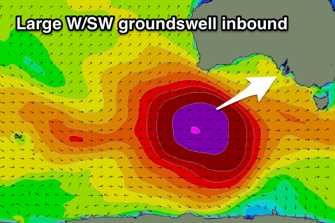
 This morning's drop in swell is only temporary, with a large and powerful long-period W/SW groundswell due to fill in strongly tomorrow, peaking later in the day/evening.
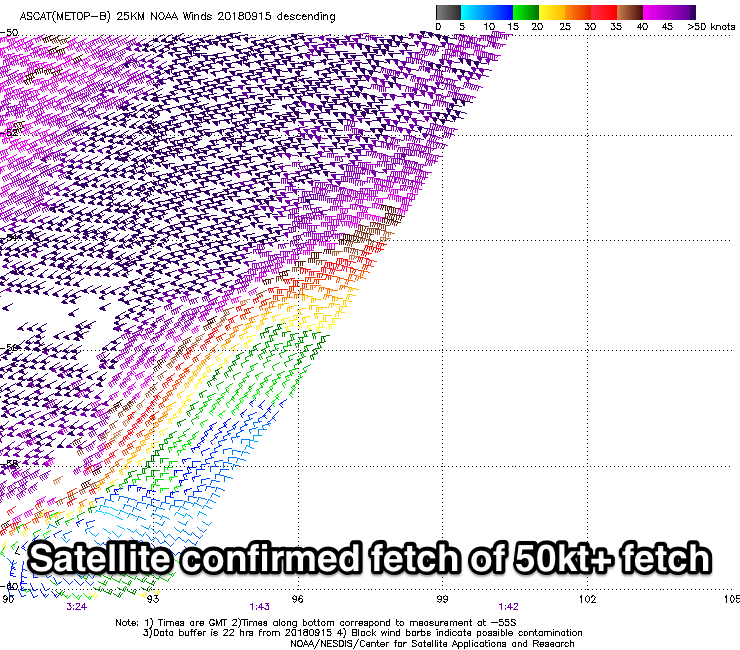
This swell started to be generated late last week as a vigorous low developed in the Heard Island region, deepening and projecting a fetch of severe-gale to storm-force W/SW winds through our medium range swell window. The low is currently weakening while projecting up towards the Bight and will push across us during tomorrow afternoon.
With winds being so strong for a good period of time, we've got a great large long-period groundswell inbound with the forerunners due to arrive early tomorrow morning ahead of the bulk of the groundswell into the mid-late afternoon, with a peak due overnight.
Middleton is expected to build from around 3ft during the morning to a large 6ft+ later in the day, with strong 3ft of groundswell developing on the Mid Coast through the afternoon.
With the remnants of the storm moving in tomorrow, winds will swing from a moderate to fresh W/NW breeze through the morning to the W/SW into the afternoon.
 The swell is expected to start easing Wednesday from 5-6ft off Middleton and 3ft on the Mid Coast with similar W/NW tending W/SW breezes, fresh in nature.
Thursday again looks similar with an early W/NW breeze down South, tending W/SW-SW through the mid-late morning as the swell continues to ease back from the 3ft+ range off Middleton, 2ft on the Mid Coast and still bumpy.
Conditions finally look better Friday with a N/NW offshore but we'll be back to small 2ft leftovers across Middleton.
Into the weekend a new S/SW groundswell is due across the South Coast Saturday morning, with better follow up pulses on the cards for Sunday and Monday owing to late forming polar storms in our swell window.
The first and least favourably aligned will generate Saturday morning's swell with a kick to 2-3ft due across most breaks with a morning NW breeze.
A trough and then high moving in through the afternoon looks to bring onshore SW tending SE to NE winds as the better S/SW swells fill in Sunday/Monday, but more on this Wednesday.


Comments
How about mentioning Amy Gore ‘queen of the bowl’ on sat also. Great young woman that rips.
Oh yes, thanks!
Any chance you can add a little more detail for the limestone coast surfers ?? Cheers
Sorry it's not quite plausible without verification from the region Boogie to be of any use.
Keep studying the weather Boogie and enjoy. There are no notes from Cape Otway to your region and beyond and I'm guessing most of the old crew from those parts like it that way ;-)
New swell is showing nicely on the CDC buoy..
Building sets at Middleton.