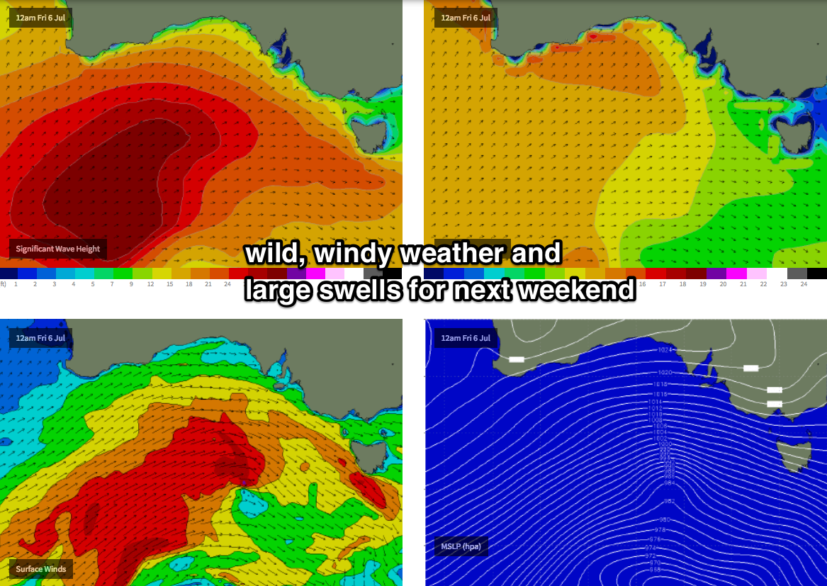
Windy period ahead, best suited to the South Coast
South Australian Surf Forecast by Ben Matson (issued Friday 29th June)
Best Days: Sat: small lumpy surf on the Mid in the a'noon as winds ease. Sun thru' next Fri: small to moderate, clean surf at Victor with offshore winds (fresh and gusty from Mon PM onwards). Small and bumpy on the Mid. Next weekend: very large and windy.
Recap: Not much happening on the Mid, very small and clean at Victor.
Today’s Forecaster Notes are brought to you by Rip Curl
This weekend (June 30 - July 1)
Want to receive an email when these Forecaster Notes are updated? Then log in here and update your preferences.
Note: Today’s Forecaster Notes will be brief, as Craig is away on annual leave. Also, these Forecaster Notes will be updated Tuesdays, Thursdays and Saturdays for the next few weeks.
It ain't an inspiring weekend ahead.
Models have slightly downgraded the approaching front (though Neptune Island is currently 30kts gusting 41kts W/SW) and the trailing fetch is short, so we won’t see a lot of size lingering into Saturday following an expected late boost in windswell this afternoon.
Winds will however ease quickly so we’ll see a steady improvement through the say and Sunday will see moderate NW winds develop.
As for size, there’ll be slow 1-2ft surf across the Mid all weekend (perhaps a few bigger windswell waves leftover early Saturday). It'll fluctuate with various phases of the tide, but there'll be waves if you're keen. Developing NW winds on Sunday certainly won't add any value but it'll still be rideable if you're desperate.
Down south, surf size will build from 1-2ft to 2-3ft at Middleton throughout Saturday, holding into Sunday. However, Sunday will be your best choice - Saturday’s rapidly easing W/SW tending W’ly winds will certainly see an improvement on the surface but it’ll remain wobbly for the most part. Expect bigger waves at exposed coasts west of Victor and east of Middleton.
Next week (July 2 onwards)
A slight reinforcement in groundswell is expected across both coasts on Monday, though in reality I’m not expecting much more size than what we’ll see on Sunday - perhaps a few bigger sets if we're lucky down south though it'l be quite inconsistent. Winds will freshen from the N/NW thru’ NW so it’ll be a better day down at Victor than on the Mid, where it’ll be small, slow and with a northerly wobble.
The rest of the forecast period is extremely tricky (though, when does the outlook not throw a curveball or three?). Whilst the Southern Ocean is very busy, most of the promising activity positioned inside our swell window is well to the far west, and thus not in a position to generate any meaningful size.
A series of underlying, overlapping long range W/SW thru' SW groundswells will provide small to moderate swells down south, and a slow moving upper level long wave trough to our west will maintain a lengthy period of fresh and gusty, sometimes gale force N/NW thru’ W/NW winds.
As such, we can expect small bumpy surf on the Mid all week, and small to moderate though clean (if somewhat blustery) surf at Victor through into Friday.
Looking further ahead, and broader pattern is tilting towards a classic wintereque series of broad, powerful Southern Ocean fronts and lows, that are likely to kick off an extended period of large windy waves across the state from Friday or Saturday onwards. If nothing else, we’ll see a couple of decent days up on the metro beaches as well.
More on that in Monday’s update. Have a great weekend!


Comments
Yesss
Jeez, it's improved down south overnight - winds never really swung onshore yesterday (just W'ly), and they're now back around to the W/NW. A bit lumpy at Middleton though clean on the face with 2-3ft sets.

