Large improving SW swell tomorrow, pumping Wednesday
South Australian Forecast by Craig Brokensha (issued Monday 18th September)
Best Days: Both coasts tomorrow afternoon, South Coast Wednesday, Mid Coast late Thursday, both coasts Friday, South Coast Saturday
Recap
Clean glassy waves to 1-1.5ft across the Mid Coast Saturday for beginners, back to 1ft yesterday with increasing N/NE winds.
The South Coast was poor and onshore Saturday while Sunday saw good conditions at breaks that handle the NE breeze with plenty of size still coming in at 3-4ft off Middleton through the morning.
We saw the swell drop steadily through the day, back to the tiny range this morning. The Mid is increasing in size with strengthening onshore winds linked to a vigorous front currently pushing in from the west. The surf should reach 2-3ft later this afternoon but with no quality.
This week and weekend (Sep 19 - 24)
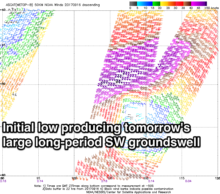
 The frontal system that's currently pushing across the state spawned off the strong low that developed in our swell window over the weekend.
This low generated an amazing slow moving fetch of severe-gale to storm-force W/SW winds in our south-western swell window, with similar strength winds continuing to be generated last night more in our southern swell window.
What we should see is a large long-period W/SW groundswell arriving later today and peaking tomorrow morning to a large 6ft+ across Middleton, with 3ft sets on the Mid Coast. There'll also be some mid-period W/SW swell from the front moving through today.
The swell will ease slightly into the afternoon, but into Wednesday, a reinforcing S/SW groundswell is due off the strong winds in our southern window last night and early this morning.
 We should see Middleton continuing around 4-5ft+ through the morning, easing into the afternoon and much smaller Thursday back to 2ft to maybe 3ft.
The Mid Coast will ease back from 1-2ft Wednesday, tiny Thursday morning ahead of a new W/SW swell later in the day.
But coming back to the local winds, and dawn tomorrow looks average across both coasts with a lingering SW breeze but an approaching front should tend winds light W/NW to NW across the South Coast into the afternoon, creating great conditions while the Mid Coast will see variable breezes out of the NW, also creating good conditions.
Wednesday looks excellent down South with a moderate to fresh N'ly tending N/NW breeze.
Come Thursday an onshore change is due out of the SW, but we are likely to see an early W/NW'ly around Victor. Wednesday is the day to surf though.
As touched on above, a good new W/SW groundswell is due later Thursday, holding Friday and easing out of the SW Saturday owing to a slow moving and strong mid-latitude low drifting in from the south-west of WA.
We'll see this low generating various fetches of strong to gale-force W/SW winds through our western swell window from today through until Wednesday resulting in a prolonged swell event.
The first stage of the swell will be quite west, edging slightly more towards south-west during its later stages.
 We should see the Mid Coast pulsing later Thursday to 1-2ft, with the South Coast not really moving much, with better sets to 2ft+ Friday on the Mid and 3ft off Middleton through the morning.
The swell will drop very slowly through Friday afternoon, down further Saturday.
Winds are looking excellent for down South, a bit bumpy on the Mid with local offshore and fresh N/NE winds Friday, W/NW Saturday and Sunday.
These W/NW winds will be linked to another mid-latitude low moving in from the west, with some good sized but messy W/SW swell due on the Mid into Sunday, but more on this Wednesday.


Comments
Cape du Couedic is back and roaring.. 5m @ 16-18s