A couple of fun days down South, larger swell for the weekend
South Australian Forecast by Craig Brokensha (issued Monday 24th July)
Best Days: South Coast Tuesday, Friday, late Friday Mid Coast, South Coast Sunday onwards
Recap
Tiny bumpy waves across the Mid Coast Saturday, increasing a little into the afternoon with a new W/SW groundswell, coming in at 1-2ft Sunday morning. A stronger pulses of W/SW swell due for the afternoon didn't reach the expected 2-3ft, and with this, this morning was undersized with easing 1-1.5ft sets on the Mid Coast.
The South Coast was tiny Saturday but a new groundswell provided some better size Sunday but with less than ideal W'ly winds. Cleaner conditions were seen this morning with similar amounts of swell to yesterday morning.
This week (Jul 25 – 28)
We've got a fun S/SW groundswell due across the South Coast tomorrow, generated by a strong polar front that's currently pushing up and under Tassie.
This swell has been upgraded a little and might not fully be in by dawn but should well and truly be in by mid-morning. Middleton should see good 3ft sets as offshore N/NW tending NW winds.
The Mid Coast is looking to be tiny now with bumpy 1ft waves, while a small mid-latitude low under WA today should generate an increase in swell Wednesday to 1-1.5ft, possibly hitting 2ft on the incoming tide.
The South Coast will see some small weak W/SW swell Wednesday from the low, coming in at 2-3ft across Middleton during the morning ahead of an easing trend through the day.
Winds look to be from the W/NW through the morning, favouring protected spots down South, with a light W/SW'ly into the afternoon.
Come Thursday, much better offshore N/NE tending NW breezes are due, but the swell will be small and fading from 1-2ft at Middleton. Waits and Parsons will be the pick.
Into the end of the week another small W/SW swell is due, produced by a small mid-latitude front passing under WA Wednesday evening, continuing further on an east-southeast track through Thursday.
The swell from this front should build Friday, reaching 2ft across the Mid into the afternoon, while the South Coast should build to 2-3ft. Conditions are looking great for Middleton again with a NW tending light N'ly breeze, and winds should become variable onto the afternoon on the Mid, opening up a fun late surf.
 This weekend onwards (Jul 29 onwards)
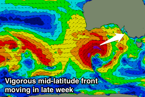
We'll finally see one of the mid-latitude systems impacting Western Australia deepening significantly south of WA and through the Bight later this week, with a broad fetch of severe-gales with embedded storm-force winds due to be projected through our swell window towards us.
A large W/SW groundswell should be generated for Sunday, coming in at this stage in the 5-6ft range off Middleton and 3ft+ on the Mid Coast but with fresh W/NW winds. Behind this secondary mid-latitude frontal activity will continue to generate plenty of swell early next week, but more on this Wednesday.


Comments
Was couple days off with the 26-28th call!
What's that sorry Polly?
Inside bowl at the Bay!