Great looking surf Friday
South Australian Forecast by Craig Brokensha (issued Wednesday 24th May)
Best Days: Thursday morning South Coast, both coasts Friday, South Coast Saturday, keen surfers Mid Coast Sunday, protected spots down South Sunday
Recap
Average bumpy 1-1.5ft waves on the Mid Coast yesterday, while today a touch more size was seen, but winds have remained average. Winds will ease off later this afternoon, so conditions should improve for the late session.
The South Coast was good and fun with 2ft waves off Middleton yesterday, bumpier and a touch bigger this morning.
This week and weekend (May 25 – 28)
Our current W/SW swell energy is expected to ease back through tomorrow on the Mid Coast, but the South Coast is expected to see a peak during the morning. Middleton should offer 2-3ft sets, smaller into the afternoon, while the Mid should ease from 1-2ft.
A NW tending W/NW breeze will favour the South Coast, while the Mid may see lighter N/NW winds at dawn, quickly deteriorating thereafter.
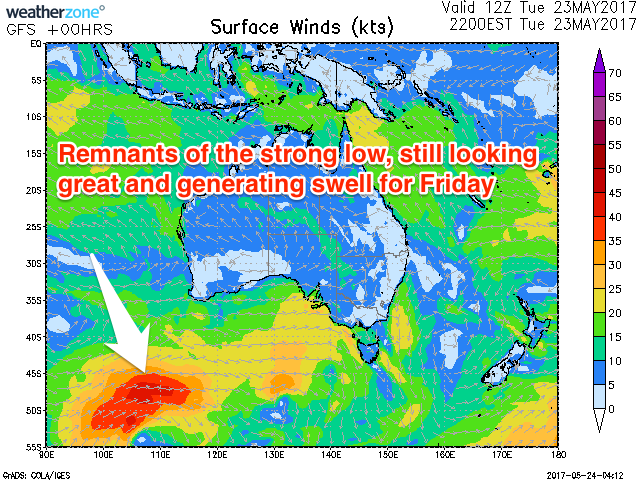
 Now, Friday's strong W/SW groundswell is on track, with a vigorous and tight low forming in the Indian Ocean, generating storm-force W'ly winds, now sitting south of WA.
A great fetch of W/SW gales is continuing to be aimed through our south-western swell window, and this system will continue pushing east while weakening this evening and tomorrow.
A good consistent W/SW groundswell will result, tending SW in direction as it peaks.
We should see the swell arrive early Friday, building quickly to 2ft on the Mid Coast, if not for the odd bigger one, while Middleton should build to 4-5ft into the mid-late afternoon.
Conditions are looking great for the South Coast with a straight N'ly tending N/NW breeze, while the Mid looks good as well as winds hold from the N/NE most of the day.
The swell should ease back into Saturday and a fresh N/NW tending W/NW breeze will favour the South Coast (while the Mid may see an early N/NE'ly if we're lucky).
Our secondary W/SW groundswell event flagged for this weekend is still expected to arrive with weather and wind.
An intense mid-latitude front forming south-west of WA will project a fetch of W/SW gales slowly through our western swell window from this evening through the coming days, moving more into our south-west swell window Saturday morning.
This should generate a large W/SW groundswell for Sunday, easing Monday, with some SW energy in the mix. There'll also be a bit of stormy windswell in the mix Sunday with a couple of strong fronts pushing across our region Saturday evening and Sunday.
We should see the Mid Coast offering stormy 3ft waves Saturday with gusty W/SW winds, while the South Coast should kick to 4-6ft with a morning W/NW breeze.
Cleaner conditions are due as the swells ease, but we'll confirm this Friday.


Comments
Here comes the swell!