Easing W/SW swell, poor down South, lots of action next week
South Australian Forecast by Craig Brokensha (issued Monday 20th March)
Best Days: Mid Coast Tuesday, South Coast Friday morning, South Coast Sunday morning
Recap
Fun clean 1-2ft waves Saturday on the Mid Coast, leftover from the strong swell seen late last week, tiny into Sunday ahead of a late kick in new W/SW groundswell.
The South Coast offered fun waves at exposed breaks with light offshore winds, while Sunday a very inconsistent groundswell providing sets after very long waits.
Today the W/SW groundswell has come in at a good 2ft on the Mid Coast with the odd bigger set at magnets (below), while the South Coast was also inconsistent and to 2-3ft off Middleton with light offshore winds.
We'll see the swell peaking this afternoon with easy 3ft sets at magnets on the Mid Coast with the incoming tide but with sea breezes.

This week (Mar 21 – 24)
Today's strong pulse of W/SW groundswell should peak this afternoon, easing off steadily through tomorrow and further Wednesday.
We should see 1-2ft sets tomorrow morning, tiny into Wednesday. SE winds are due to keep conditions clean for the most part both days.
The outlook for the South Coast is terrible, with a strengthening surface trough moving in from the west due to slowly push further east across the south-east of the country, forming into a low off Tassie's East Coast.
This will direct persistent and strong SE-S/SE winds into the South Coast, generating building levels of S/SE windswell, reaching a chunky size into Wednesday, easing off slowly into the end of the week.
This will also spoil a good new S/SW groundswell expected later Wednesday and Thursday morning, produced by an intense polar low the last couple of days.
Light NE offshores are expected into Friday morning but the swell will be smaller and back to 2ft+ across Middleton and 3-4ft at Waits and Parsons.
The Mid Coast isn't due to see any real size from the S/SW swell at all and will become tiny to flat.
This weekend onwards (Feb 25 onwards)
 A couple of small S/SW groundswell pulses are due over the weekend, the first for Saturday and second slightly better pulse Sunday.
These two swells will be generated by pre-frontal W/NW fetches through our medium-range swell window, south-west of WA close to the polar shelf.
Saturday's looks small and only around 2ft, with a little more size into Sunday. Light S'ly winds are expected Saturday with light offshore N/NE winds Sunday, but there's more interesting developments into next week.
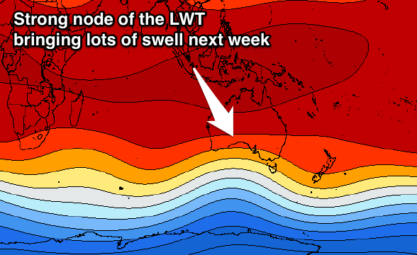
A strong node of the Long Wave Trough is forecast to move in from the west early next week, and with this we'll see a flurry of strong mid-latitude frontal activity. A series of moderate to large W/SW groundswells are due through next week, but we'll look at this in more detail on Wednesday.

