Strong W/SW swells to come
South Australian Forecast by Craig Brokensha (issued Wednesday 15th March)
Best Days: Mid Coast later tomorrow and Friday morning, South Coast Saturday and Sunday mornings, Mid Coast Monday
Recap
Small across the South Coast yesterday morning but nice and clean while the Mid Coast was tiny. Into the afternoon though a strong new SW groundswell filled in, providing good fun sets off Middleton even with the onshore wind.
The swell held early this morning with great conditions down South which should persist most of the day as the swell eases. The Mid Coast was tiny to flat.
This week and weekend (Mar 16 – 19)
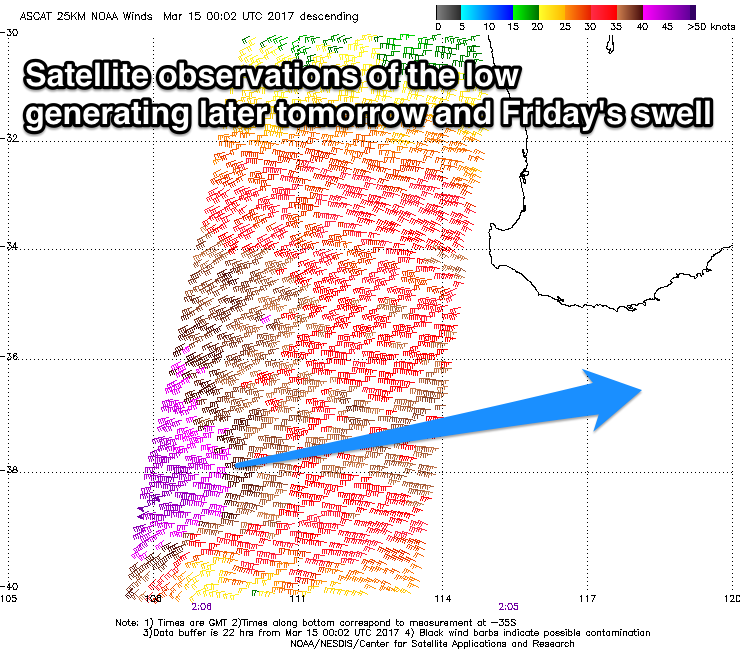
 Later tonight an onshore change will move through, linked to a severe but weakening low that pushed into WA yesterday that is now moving through the Bight.
This low has generated a tight fetch of gale to severe-gale W/SW winds through our western swell window (pictured) and will generate weaker W/SW winds while moving through the Bight today before crossing us this evening.
What we'll see tomorrow across the Mid Coast is a W/SW windswell for the morning to 2ft, followed by a stronger W/SW groundswell later in the day, peaking Friday morning.
3ft sets are due to develop by dark with similar sized waves Friday morning, easing into the afternoon and further Saturday back to 1-2ft.
The South Coast isn't due to see much of the W'ly groundswell at all, with some W/SW windswell for tomorrow afternoon and Friday morning but with poor conditions.
Tomorrow we're looking at fresh and gusty SW winds, tending more S'ly through the afternoon and S/SE later on the Mid Coast.
 Friday should then see E/SE offshores on the Mid and E/SE tending E'ly winds down South, cleaning up conditions slightly.
Saturday looks much better across the South Coast with easing surf from 2ft at Middleton with a N/NE offshore before sea breezes kick in.
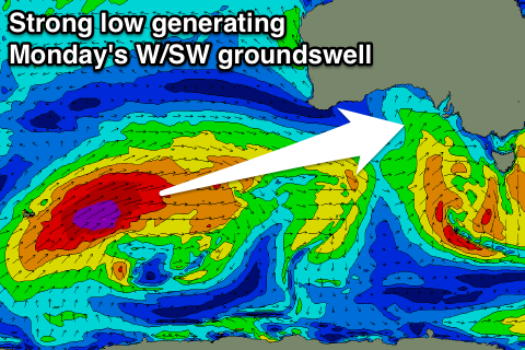
Now, into Sunday and more so Monday some new W/SW is due across the state. There'll be two pulses seen, the first very inconsistent and generated by the initial stages of a very strong low that developed south-east of South Africa on Monday.
This low has since pushed slowly east and will re-intensify while projecting towards WA through our western swell window. A great fetch of severe-gale to near storm-force W/SW winds will be generated, producing a secondary better W/SW groundswell.
The first very inconsistent and small W/SW groundswell is due Sunday, building slowly from a small 2ft at Middleton to 3ft+ into the afternoon, while the Mid isn't due to see much size over 1-1.5ft if that.
The stronger swell Monday should peak during the morning to 3-5ft off Middleton, larger at Waits and Parsons, with 2-3ft sets on the Mid Coast.
Winds on Sunday will be offshore ahead of a late S'ly change, and then SE-S/SE winds on Monday, favouring the Mid over South Coast. As the swell eases Tuesday morning light NE winds are due down South, but we'll confirm this Friday.

